MyTopo
Athelstane Wisconsin US Topo Map
Couldn't load pickup availability
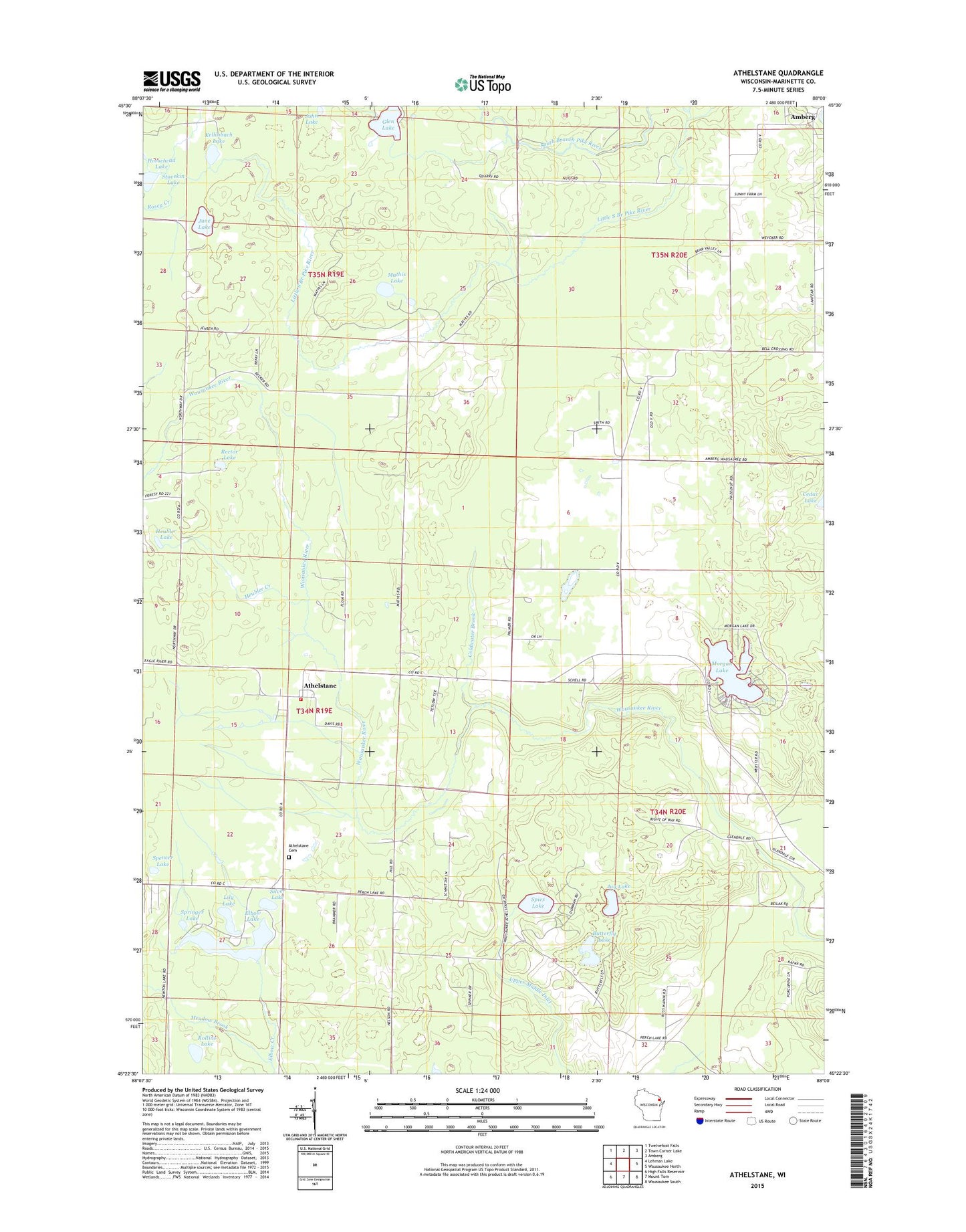
2022 topographic map quadrangle Athelstane in the state of Wisconsin. Scale: 1:24000. Based on the newly updated USGS 7.5' US Topo map series, this map is in the following counties: Marinette. The map contains contour data, water features, and other items you are used to seeing on USGS maps, but also has updated roads and other features. This is the next generation of topographic maps. Printed on high-quality waterproof paper with UV fade-resistant inks.
Quads adjacent to this one:
West: Lehman Lake
Northwest: Twelvefoot Falls
North: Town Corner Lake
Northeast: Amberg
East: Wausaukee North
Southeast: Wausaukee South
South: Mount Tom
Southwest: High Falls Reservoir
This map covers the same area as the classic USGS quad with code o45088d1.
Contains the following named places: Amberg State Public Hunting Grounds, Assembly of God Church, Athelstane, Athelstane Cemetery, Athelstane Post Office, Athelstane Volunteer Fire Department, Bear Lake, Brown School, Butterfly Lake, Cedarville Lookout Tower, Coldwater Brook, Cowie School, Elbow Creek, Elbow Lake, Glen Lake, Glendale School, Heubler Creek, Heubler Lake, John Lake, Jug Lake, June Lake, Kellinbach Lake, Lauenmans Lake, Lily Lake, Little South Branch Pike River, Mathis Church, Mathis Lake, Meadow Brook, Morgan Lake, Rector Lake, Rector School, Rollins Lake, Rosey Creek, Silver Lake, Spencer Lake, Spies Lake, Springer Lake, Stovekin Lake