MyTopo
Fairchild Wisconsin US Topo Map
Couldn't load pickup availability
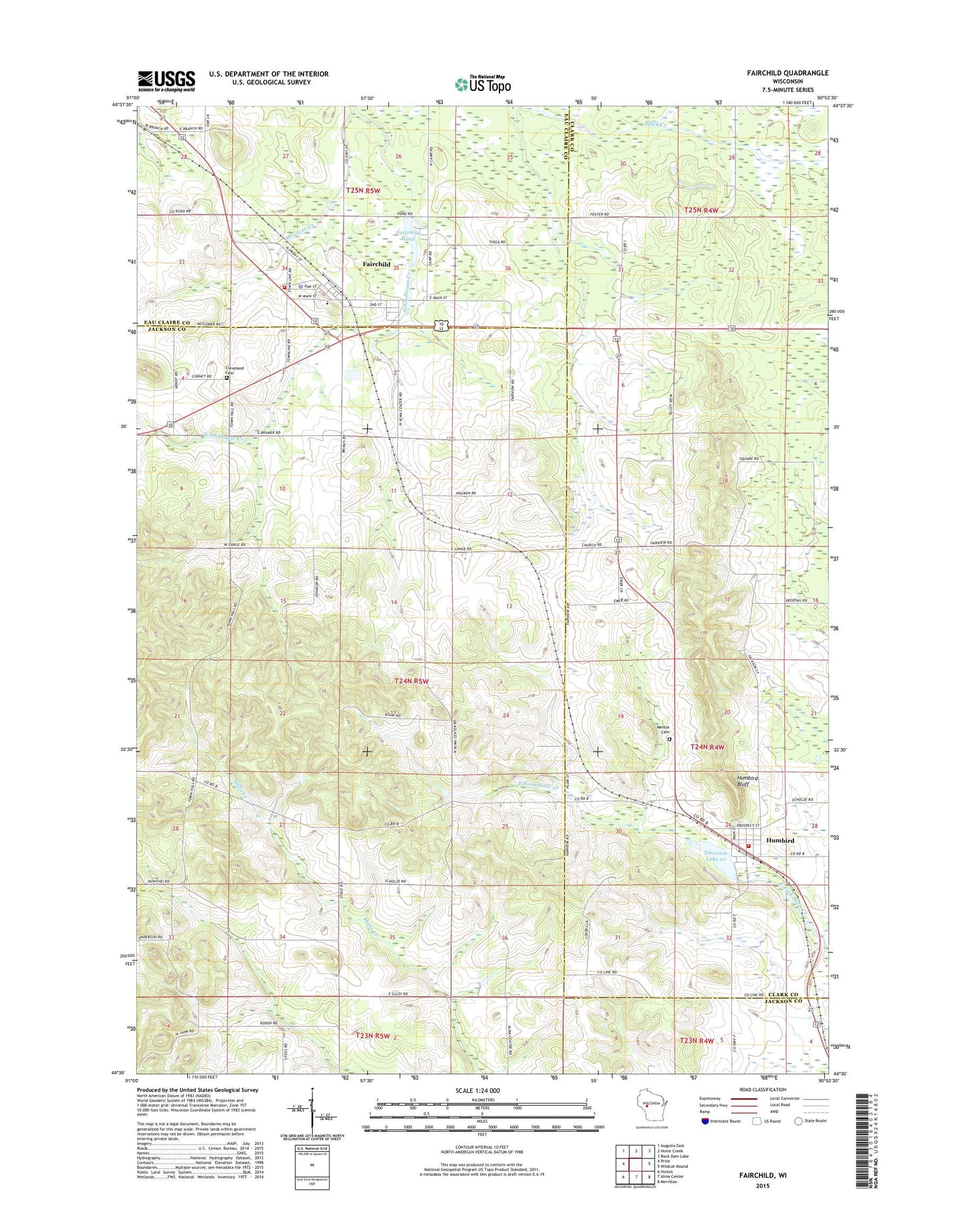
2022 topographic map quadrangle Fairchild in the state of Wisconsin. Scale: 1:24000. Based on the newly updated USGS 7.5' US Topo map series, this map is in the following counties: Jackson, Clark, Eau Claire. The map contains contour data, water features, and other items you are used to seeing on USGS maps, but also has updated roads and other features. This is the next generation of topographic maps. Printed on high-quality waterproof paper with UV fade-resistant inks.
Quads adjacent to this one:
West: Price
Northwest: Augusta East
North: Horse Creek
Northeast: Rock Dam Lake
East: Wildcat Mound
Southeast: Merrillan
South: Alma Center
Southwest: Hixton
This map covers the same area as the classic USGS quad with code o44090e8.
Contains the following named places: Cleveland Cemetery, Emerson Lake, Fairchild, Fairchild C4772 Dam, Fairchild Elementary School, Fairchild Fire Protection District, Fairchild Police Department, Fairchild Pond, Fairchild Post Office, Humbird, Humbird Bluff, Humbird Census Designated Place, Humbird Dam, Humbird Post Office, Humbird Volunteer Fire Department, Lone Pine School, McGaver Creek, Mentor Cemetery, Saint Joseph Church, Sunnybrook School, Sunnyside School, Town of Cleveland, Twin Mound Lookout Tower, Van Horn School, Village of Fairchild, ZIP Codes: 54741, 54746