MyTopo
Rock Dam Lake Wisconsin US Topo Map
Couldn't load pickup availability
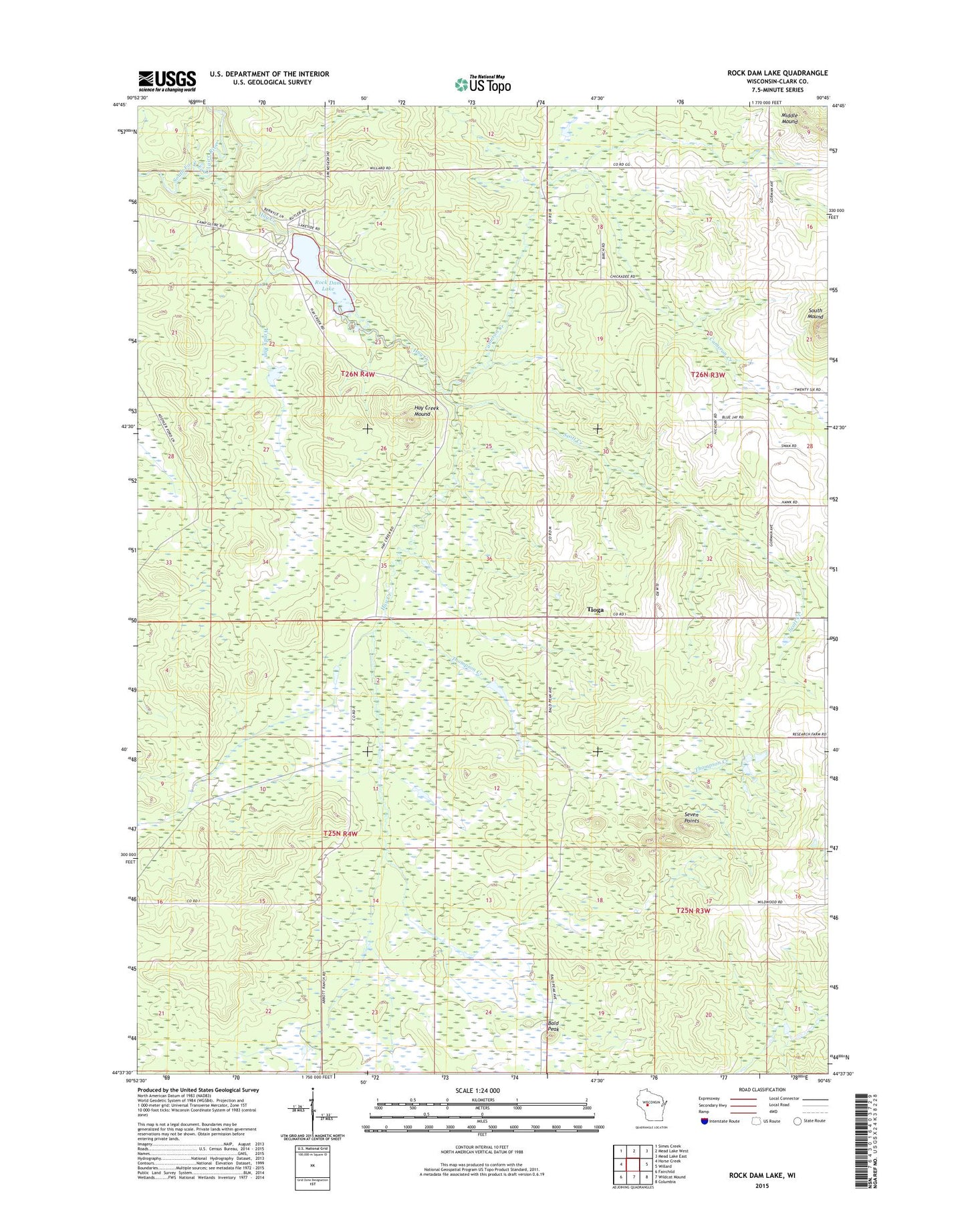
2022 topographic map quadrangle Rock Dam Lake in the state of Wisconsin. Scale: 1:24000. Based on the newly updated USGS 7.5' US Topo map series, this map is in the following counties: Clark. The map contains contour data, water features, and other items you are used to seeing on USGS maps, but also has updated roads and other features. This is the next generation of topographic maps. Printed on high-quality waterproof paper with UV fade-resistant inks.
Quads adjacent to this one:
West: Horse Creek
Northwest: Simes Creek
North: Mead Lake West
Northeast: Mead Lake East
East: Willard
Southeast: Columbia
South: Wildcat Mound
Southwest: Fairchild
This map covers the same area as the classic USGS quad with code o44090f7.
Contains the following named places: 16 Reservoir, 54493, Bald Peak, Blackberry School, Cameron Creek, Clark County 16 Dam, Clark County Number 10 G328 Dam, Dam Number Sixteen, Dam Number Ten, Dam Number Twelve, Hay Creek, Hay Creek Lake 59, Hay Creek Mound, Lake 22-13, Lookout Tower, McKinley School, Rock 2WP297 Dam, Rock Dam County Park, Rock Dam Lake, Scott Creek, Seven Points, Thompson Creek, Tioga, Town of Foster, Wildwood School, Windy Run