MyTopo
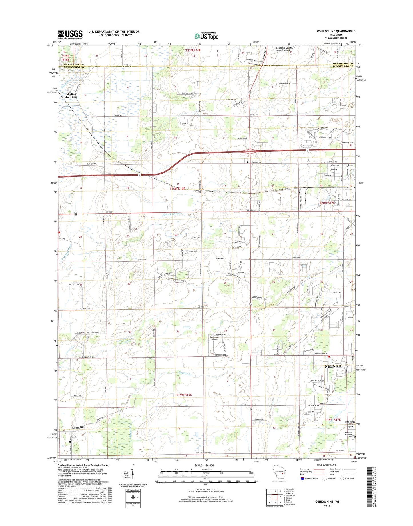
Oshkosh NE Wisconsin US Topo Map
Couldn't load pickup availability
2022 topographic map quadrangle Oshkosh NE in the state of Wisconsin. Scale: 1:24000. Based on the newly updated USGS 7.5' US Topo map series, this map is in the following counties: Winnebago, Outagamie. The map contains contour data, water features, and other items you are used to seeing on USGS maps, but also has updated roads and other features. This is the next generation of topographic maps. Printed on high-quality waterproof paper with UV fade-resistant inks.
Quads adjacent to this one:
West: Oshkosh NW
Northwest: Hortonville
North: Greenville
Northeast: Appleton
East: Neenah
Southeast: Indian Point
South: Oshkosh
Southwest: Omro
This map covers the same area as the classic USGS quad with code o44088b5.
Contains the following named places: Allen Farms, Allenville, Allenville Cemetery, Brennand Airport, Clayton - Winchester Fire Department Station 43, Clayton Elementary School, Gillingham School, Greenlawn Memorial Park, Immanuel Church, Larsen, Larsen Post Office, Mastalish Farm, Medina Junction, Oshkosh-Larsen Trail Prairies State Natural Area, Reinke Farm, Ridgeway Country Club, Town of Clayton, Town of Neenah Volunteer Fire Department, ZIP Code: 54956