MyTopo
Jump River Fire Tower Wisconsin US Topo Map
Couldn't load pickup availability
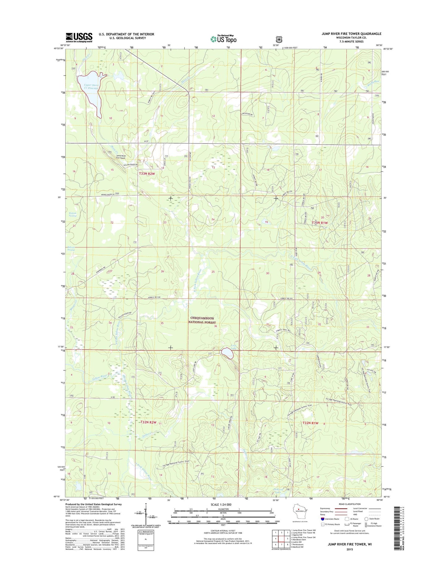
2018 topographic map quadrangle Jump River Fire Tower in the state of Wisconsin. Scale: 1:24000. Based on the newly updated USGS 7.5' US Topo map series, this map is in the following counties: Taylor. The map contains contour data, water features, and other items you are used to seeing on USGS maps, but also has updated roads and other features. This is the next generation of topographic maps. Printed on high-quality waterproof paper with UV fade-resistant inks.
Quads adjacent to this one:
West: Jump River Fire Tower SW
Northwest: Jump River Fire Tower NW
North: Jump River Fire Tower NE
Northeast: Ogema NW
East: Mondeaux Dam
Southeast: Medford NW
South: Perkinstown
Southwest: Lublin NW
Contains the following named places: Ice Age Trail, Jump River Fire Tower, Lost Lake, Mauer Creek, North Fork Yellow River, Pickerel Lake, Sailor Creek, South Fork Yellow River, Steve Creek Water Fowl 2WP 1669 Dam, Upper Steve Creek Flowage, Upper Steve Creek Flowage 9, Upper Steve Creek Waterfowl Area