MyTopo
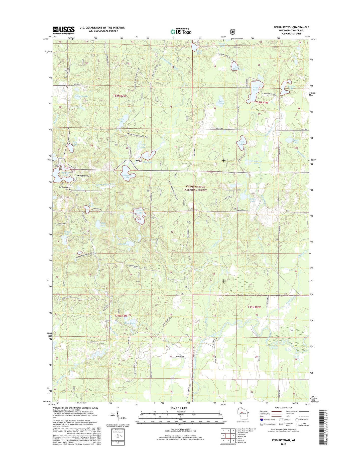
Perkinstown Wisconsin US Topo Map
Couldn't load pickup availability
Also explore the Perkinstown Forest Service Topo of this same quad for updated USFS data
2022 topographic map quadrangle Perkinstown in the state of Wisconsin. Scale: 1:24000. Based on the newly updated USGS 7.5' US Topo map series, this map is in the following counties: Taylor. The map contains contour data, water features, and other items you are used to seeing on USGS maps, but also has updated roads and other features. This is the next generation of topographic maps. Printed on high-quality waterproof paper with UV fade-resistant inks.
Quads adjacent to this one:
West: Lublin NW
Northwest: Jump River Fire Tower SW
North: Jump River Fire Tower
Northeast: Mondeaux Dam
East: Medford NW
Southeast: Medford SW
South: Lublin SE
Southwest: Lublin
This map covers the same area as the classic USGS quad with code o45090b5.
Contains the following named places: 1 Reservoir, Anderson Lake, Birch Lake, Cranberry Lake, Dennis Gisvold E4894 Dam, Eska Lake, Foss Lake, Foss Lake Forest Service Station, Horten Lake, Hulls Lake, Jerry Lake, Kathryn Lake, Kathryn Lake Campground, Keyes Lake, Kleutch Lake, Lake Eleven, Lake Nineteen, Lake Thirty, Long Lake, Maurer Creek, Mud Lake, Nancy Lake, Paradise Creek, Perkinstown, Perkinstown Cemetery, Perkinstown Lookout Tower, Polack Lake, Richter Lake, Salem Lake, Sawyer Dam School, Scoof Lake, Sue Lake, Taylor County, Thief Lake, Town of Grover