MyTopo
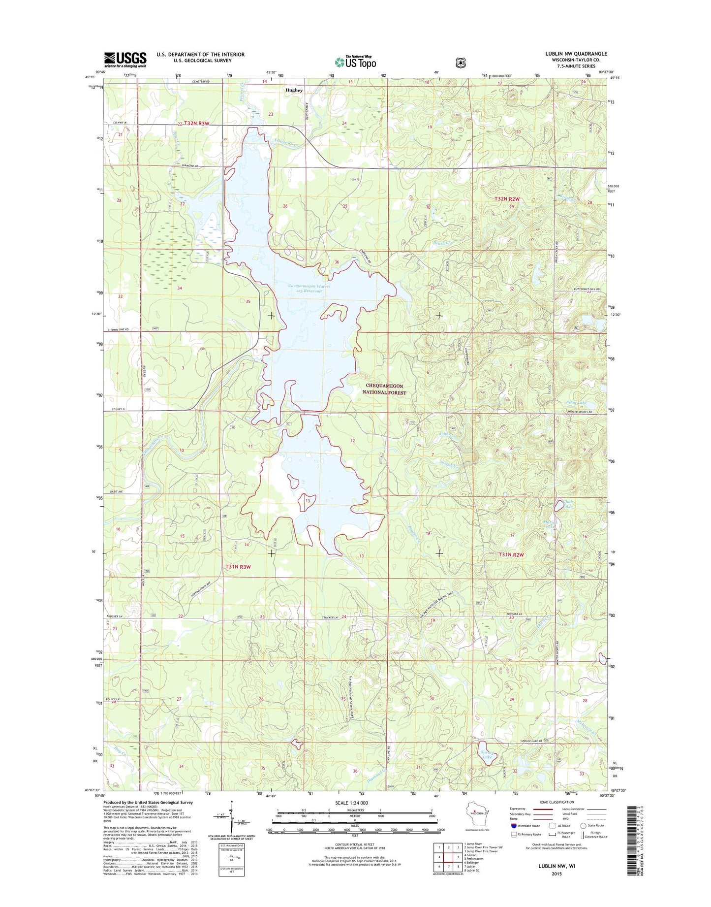
Lublin NW Wisconsin US Topo Map
Couldn't load pickup availability
Also explore the Lublin NW Forest Service Topo of this same quad for updated USFS data
2022 topographic map quadrangle Lublin NW in the state of Wisconsin. Scale: 1:24000. Based on the newly updated USGS 7.5' US Topo map series, this map is in the following counties: Taylor. The map contains contour data, water features, and other items you are used to seeing on USGS maps, but also has updated roads and other features. This is the next generation of topographic maps. Printed on high-quality waterproof paper with UV fade-resistant inks.
Quads adjacent to this one:
West: Gilman
Northwest: Jump River
North: Jump River Fire Tower SW
Northeast: Jump River Fire Tower
East: Perkinstown
Southeast: Lublin SE
South: Lublin
Southwest: Bellinger
This map covers the same area as the classic USGS quad with code o45090b6.
Contains the following named places: 0.33 Reservoir, Bear Creek, Bear Creek Waterfowl Area, Beaver Creek, Beaver Creek Waterfowl Area, Brush Creek, Chequamegon Waters 2WP2068 Dam, Chequamegon Waters Flowage, Chippewa Campground, Chub Lake, Hughey, John Zester G1765 Dam, Johns Creek, Joseph Creek, Marion Lake, Miller Dam, Nona Lake, Perkinstown Winter Sports Area, Spruce Lake, Thirty-Three Lake, Town of Cleveland, Town of Ford, Weasel Creek