MyTopo
Medford NW Wisconsin US Topo Map
Couldn't load pickup availability
Also explore the Medford NW Forest Service Topo of this same quad for updated USFS data
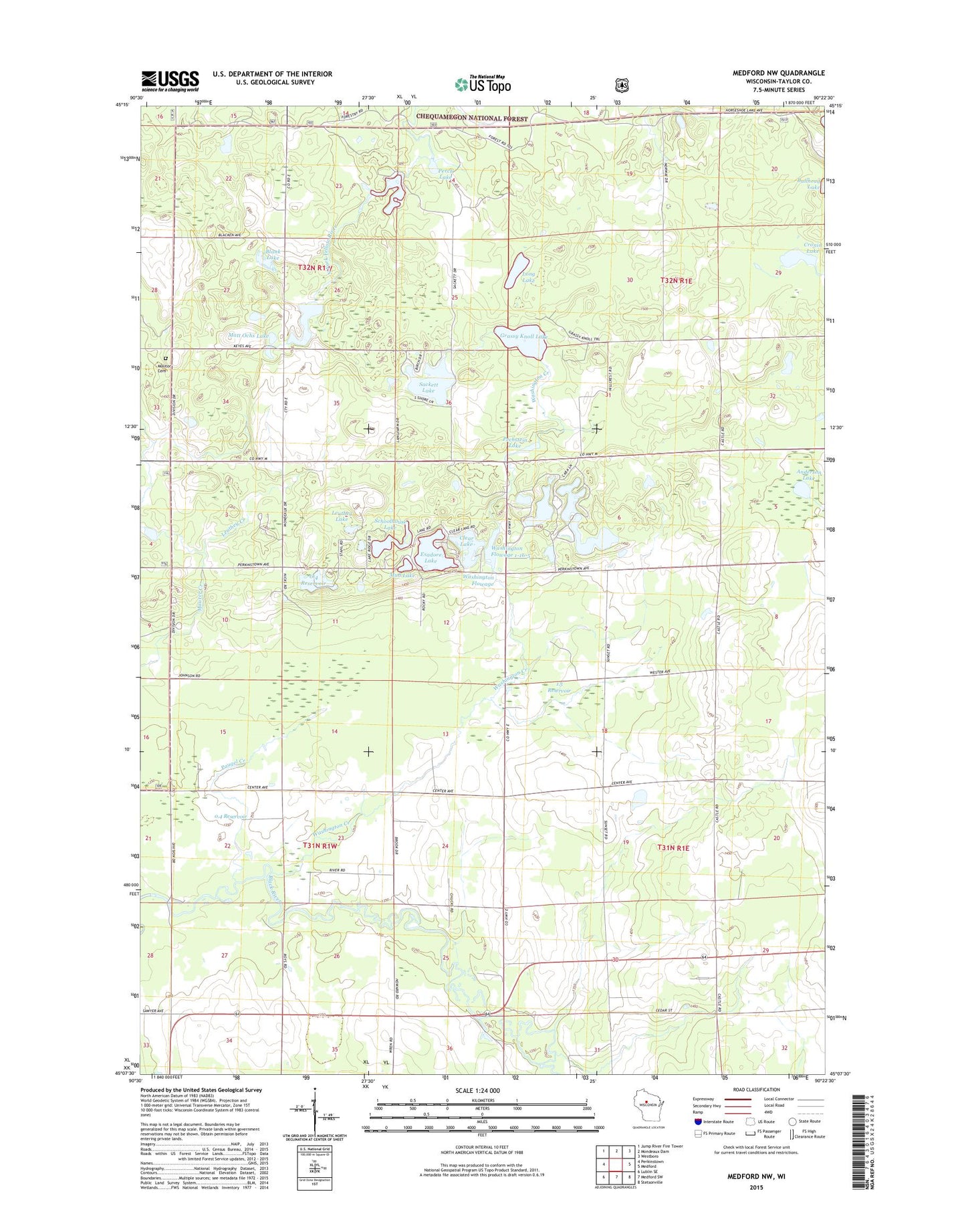
2022 topographic map quadrangle Medford NW in the state of Wisconsin. Scale: 1:24000. Based on the newly updated USGS 7.5' US Topo map series, this map is in the following counties: Taylor. The map contains contour data, water features, and other items you are used to seeing on USGS maps, but also has updated roads and other features. This is the next generation of topographic maps. Printed on high-quality waterproof paper with UV fade-resistant inks.
Quads adjacent to this one:
West: Perkinstown
Northwest: Jump River Fire Tower
North: Mondeaux Dam
Northeast: Westboro
East: Medford
Southeast: Stetsonville
South: Medford SW
Southwest: Lublin SE
This map covers the same area as the classic USGS quad with code o45090b4.
Contains the following named places: 0.4 Reservoir, 0.6 Reservoir, 1.5 Reservoir, 54451, Anderson Lake, Blank Lake, Bradow Dam D 8092, Brookside School, Clear Lake, Clear Lake Dam, Cleveland School, Cronin Lake, Dr Walther W Meyer Number 1 D4754 Dam, Esadore Lake, Farm View School, Grassy Knoll Lake, Hammel Townhall, Leuthey Creek, Leuthey Lake, Long Lake, Matt Ochs Lake, Meadowbrook School, Meadownook School, Meyer 1 G3582.1 Dam, Meyer 2 G3582.1 Dam, Meyer 4 G3582.1 Dam, Meyer 5 G3582.1 Dam, Meyer 6 E1355.1 Dam, Molitor Cemetery, Molitor Townhall, Mud Lake, Murat, Nick Henrichs G-9011 Dam, Patrick J Meyer 3NW78801 Dam, Paugel Creek, Pechstein Lake, Perch Lake, Pine Tree School, Romeo Lake, Sackett Lake, Sackett Lake Recreation Area, Schoolhouse Lake, Steenhoven Dam, Thielke School, Tiffany Lake, Town of Hammel, Town of Molitor, Washington Creek, Washington Flowage, Wayside School