MyTopo
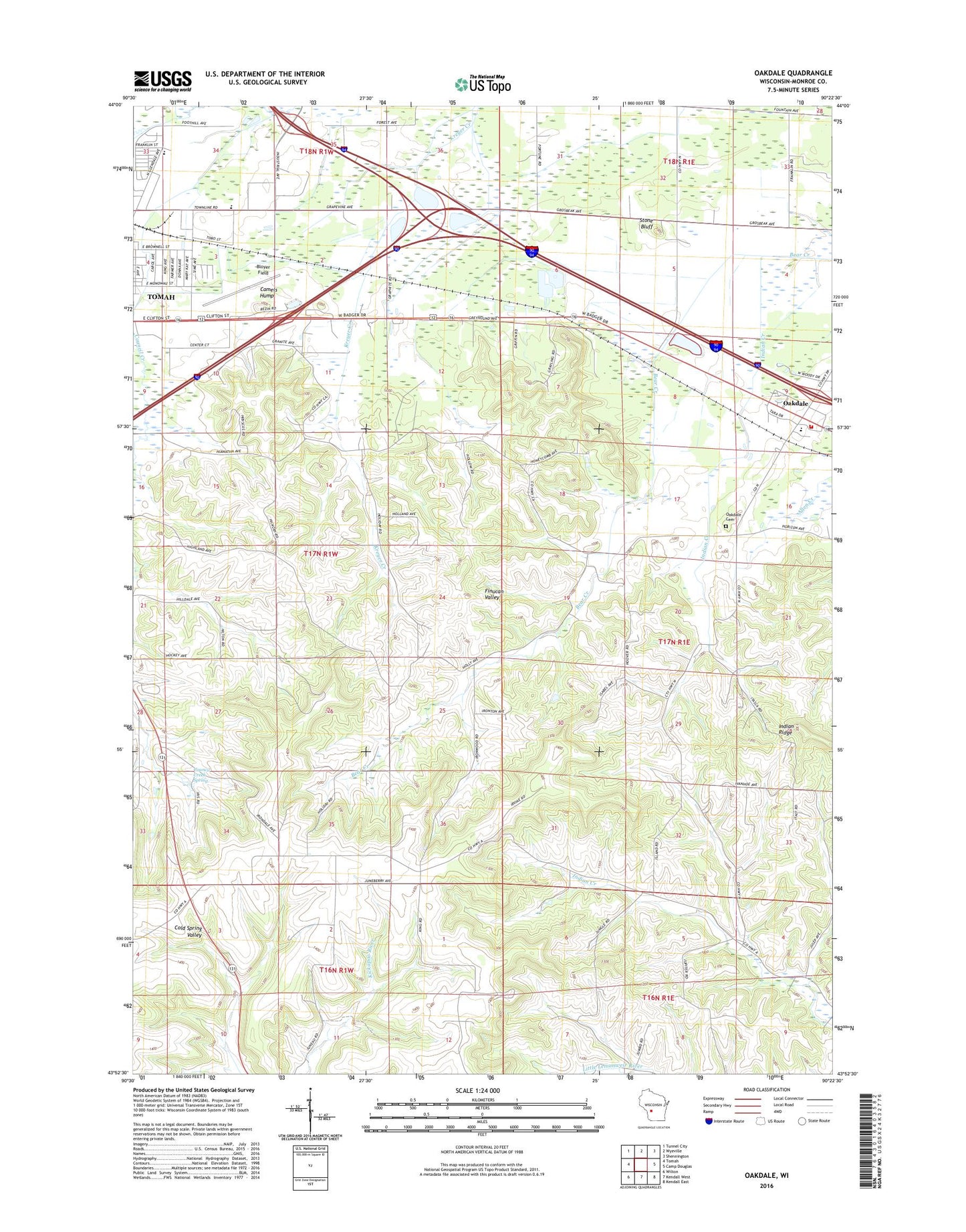
Oakdale Wisconsin US Topo Map
Couldn't load pickup availability
2022 topographic map quadrangle Oakdale in the state of Wisconsin. Scale: 1:24000. Based on the newly updated USGS 7.5' US Topo map series, this map is in the following counties: Monroe. The map contains contour data, water features, and other items you are used to seeing on USGS maps, but also has updated roads and other features. This is the next generation of topographic maps. Printed on high-quality waterproof paper with UV fade-resistant inks.
Quads adjacent to this one:
West: Tomah
Northwest: Tunnel City
North: Wyeville
Northeast: Shennington
East: Camp Douglas
Southeast: Kendall East
South: Kendall West
Southwest: Wilton
This map covers the same area as the classic USGS quad with code o43090h4.
Contains the following named places: Bear Creek School, Bloyer Field, Camels Hump, City of Tomah, Council Creek, Council Creek School, Council Creek Spring, Deer Creek, Fireman Park, Gerke Quarry, Glendale Ball Park, Hill School, Indian Creek, Indian Ridge, Kingdom Hall, Lemonweir Elementary School, Mound View School, Oakdale, Oakdale Area Fire Department Oakdale Station, Oakdale Cemetery, Oakdale Elementary School, Oakdale Post Office, Robert Kupper Learning Center, Saint Michael Church, Saint Peter Church, Stone Bluff, Sunny Ridge School, Tomah Industrial Park, Town of Tomah, Veterans Park, Village of Oakdale, Western Wisconsin Technical College - Tomah Center, WRTL-FM (Tomah), ZIP Code: 54660