MyTopo
Kennan NW Wisconsin US Topo Map
Couldn't load pickup availability
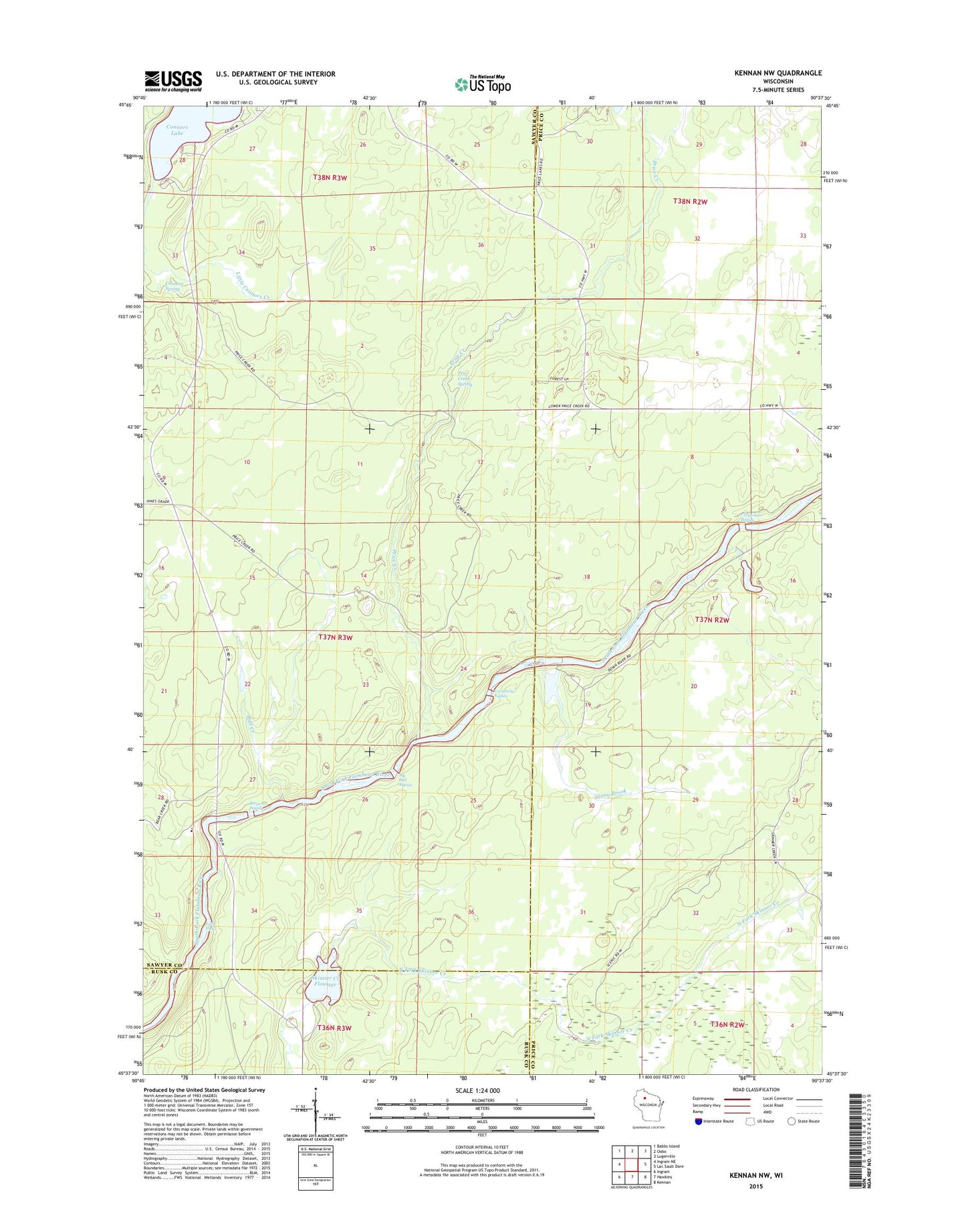
2018 topographic map quadrangle Kennan NW in the state of Wisconsin. Scale: 1:24000. Based on the newly updated USGS 7.5' US Topo map series, this map is in the following counties: Sawyer, Price, Rusk. The map contains contour data, water features, and other items you are used to seeing on USGS maps, but also has updated roads and other features. This is the next generation of topographic maps. Printed on high-quality waterproof paper with UV fade-resistant inks.
Quads adjacent to this one:
West: Ingram NE
Northwest: Babbs Island
North: Oxbo
Northeast: Lugerville
East: Lac Sault Dore
Southeast: Kennan
South: Hawkins
Southwest: Ingram
Contains the following named places: Bergeron Rapids, Big Bull Rapids, Bull Creek, Camp Flambeau, Carpenters Rapids, Connors Spring, Cornsheller Rapids, Flambeau Correctional Center School, Kimberly-Clark Wildlife Area, Kraft Camp, Little Connors Creek, Little Falls, Price Creek, Price Creek Spring, Skinner Creek Flowage, Sobieski C14690.1 Dam, Stony Brook