MyTopo
Babbs Island Wisconsin US Topo Map
Couldn't load pickup availability
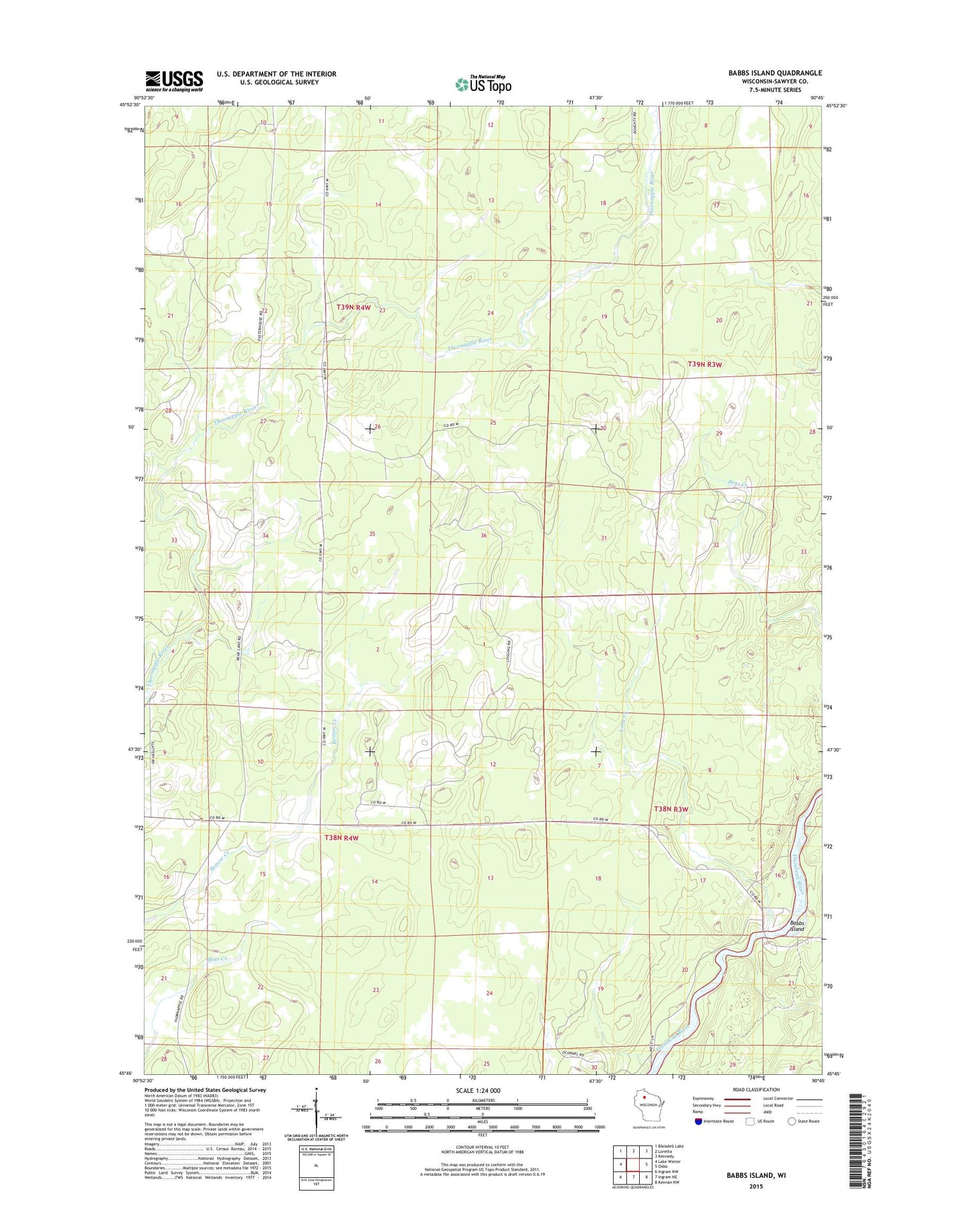
2022 topographic map quadrangle Babbs Island in the state of Wisconsin. Scale: 1:24000. Based on the newly updated USGS 7.5' US Topo map series, this map is in the following counties: Sawyer. The map contains contour data, water features, and other items you are used to seeing on USGS maps, but also has updated roads and other features. This is the next generation of topographic maps. Printed on high-quality waterproof paper with UV fade-resistant inks.
Quads adjacent to this one:
West: Lake Winter
Northwest: Blaisdell Lake
North: Loretta
Northeast: Kennedy
East: Oxbo
Southeast: Kennan NW
South: Ingram NE
Southwest: Ingram NW
This map covers the same area as the classic USGS quad with code o45090g7.
Contains the following named places: Babbs Island, Long Creek, Newald Camp, Old Jackson Camp, Old Koshack Camp, Thornapple School