MyTopo
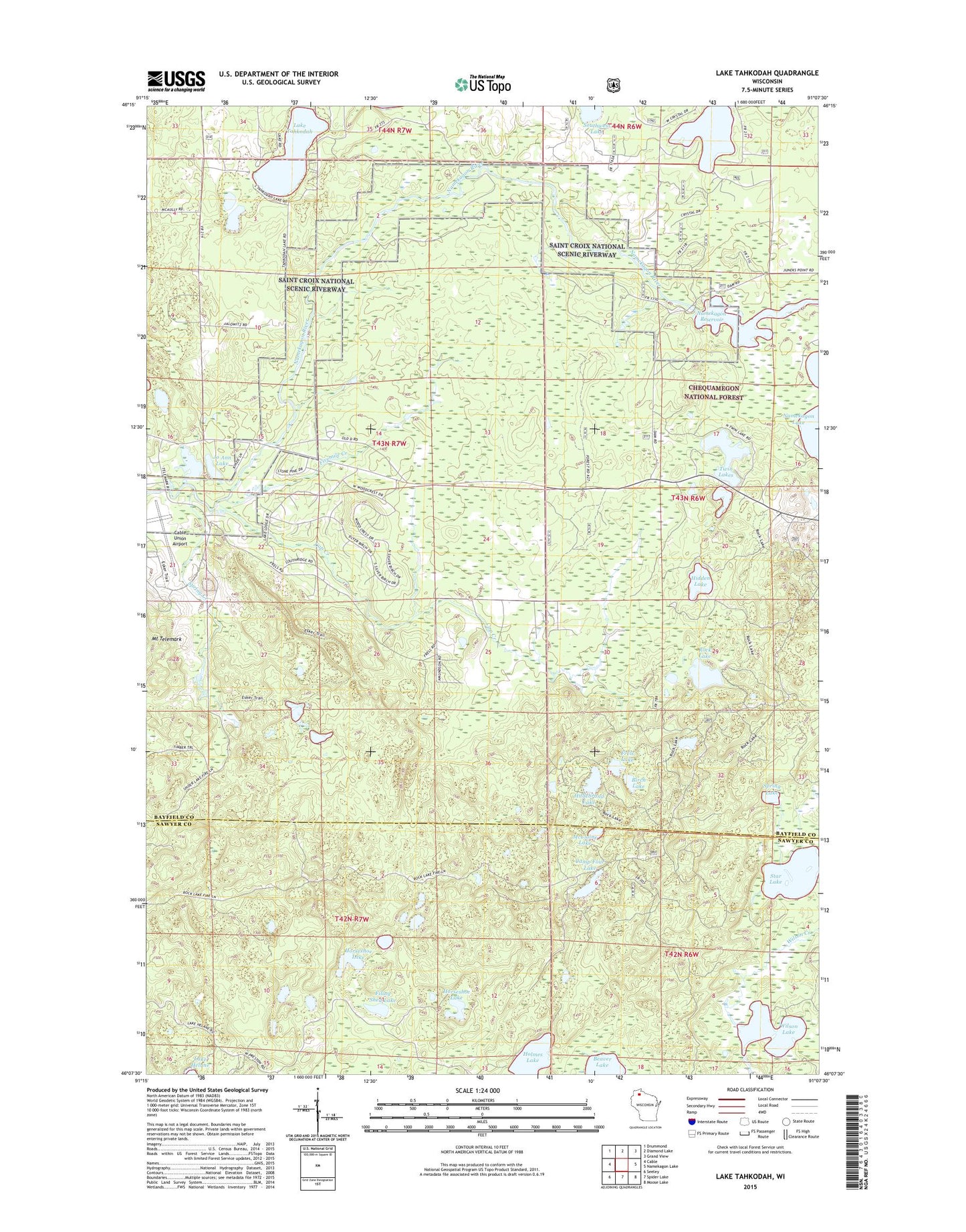
Lake Tahkodah Wisconsin US Topo Map
Couldn't load pickup availability
Also explore the Lake Tahkodah Forest Service Topo of this same quad for updated USFS data
2022 topographic map quadrangle Lake Tahkodah in the state of Wisconsin. Scale: 1:24000. Based on the newly updated USGS 7.5' US Topo map series, this map is in the following counties: Bayfield, Sawyer. The map contains contour data, water features, and other items you are used to seeing on USGS maps, but also has updated roads and other features. This is the next generation of topographic maps. Printed on high-quality waterproof paper with UV fade-resistant inks.
Quads adjacent to this one:
West: Cable
Northwest: Drummond
North: Diamond Lake
Northeast: Grand View
East: Namekagon Lake
Southeast: Moose Lake
South: Spider Lake
Southwest: Seeley
This map covers the same area as the classic USGS quad with code o46091b2.
Contains the following named places: Beaver Lake, Birch Lake, Cable Union Airport, Camp Four Lake, Cap Creek, Crystal Lake, Emerson Lake, Filing Shed Lake, Fivemile Creek, Frels Lake, Hidden Lake, Hildebrand Lake, Holmes Lake, Horseshoe Lake, Jo Ann Lake, Johnson Lake, Lake Tahkodah, McClaine Lake, Namekagon 41 Reservoir, Namekgon WP320 Dam, Rock Lake, Rock Lake National Recreation Trail, Southwest Lake, Spring Creek, Spring Lake, Star Lake, Tahkodah Hills Golf Course, Trail Lake, Twin Lakes, Wilson Lake, ZIP Code: 54821