MyTopo
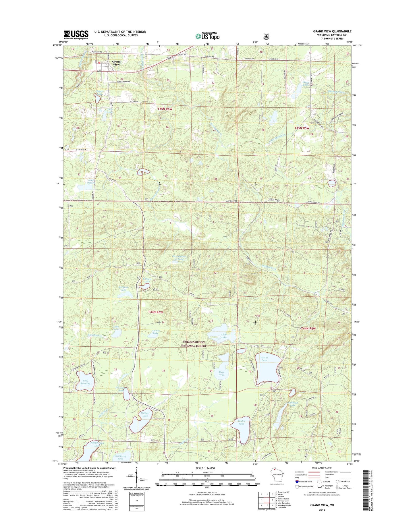
Grand View Wisconsin US Topo Map
Couldn't load pickup availability
Also explore the Grand View Forest Service Topo of this same quad for updated USFS data
2022 topographic map quadrangle Grand View in the state of Wisconsin. Scale: 1:24000. Based on the newly updated USGS 7.5' US Topo map series, this map is in the following counties: Bayfield. The map contains contour data, water features, and other items you are used to seeing on USGS maps, but also has updated roads and other features. This is the next generation of topographic maps. Printed on high-quality waterproof paper with UV fade-resistant inks.
Quads adjacent to this one:
West: Diamond Lake
Northwest: Grandview NW
North: Mason
Northeast: Sanborn
East: Marengo Lake
Southeast: Clam Lake
South: Namekagon Lake
Southwest: Lake Tahkodah
This map covers the same area as the classic USGS quad with code o46091c1.
Contains the following named places: Atkins Lake, Bass Lake, Bullhead Lake, Club Lake, Cranberry Lake, Deer Lake, East Davis Lake, Friedbauer Lake, Grand View, Grand View Census Designated Place, Grand View Fire Department, Grand View Post Office, Holmes Lake, Jackson Creek, Lake Knotting, Lake Lizzie, Lake Osborn, Little Spring Creek, Long Mile Lookout Tower, Olson Lake, Pre-emption Creek, Pre-emption Creek Pond, Siegal Lake, Spruce Lake, Taylor Lake, Town of Grandview, Trapper Lake, University of Wisconsin Surveying Camp, West Davis Lake