MyTopo
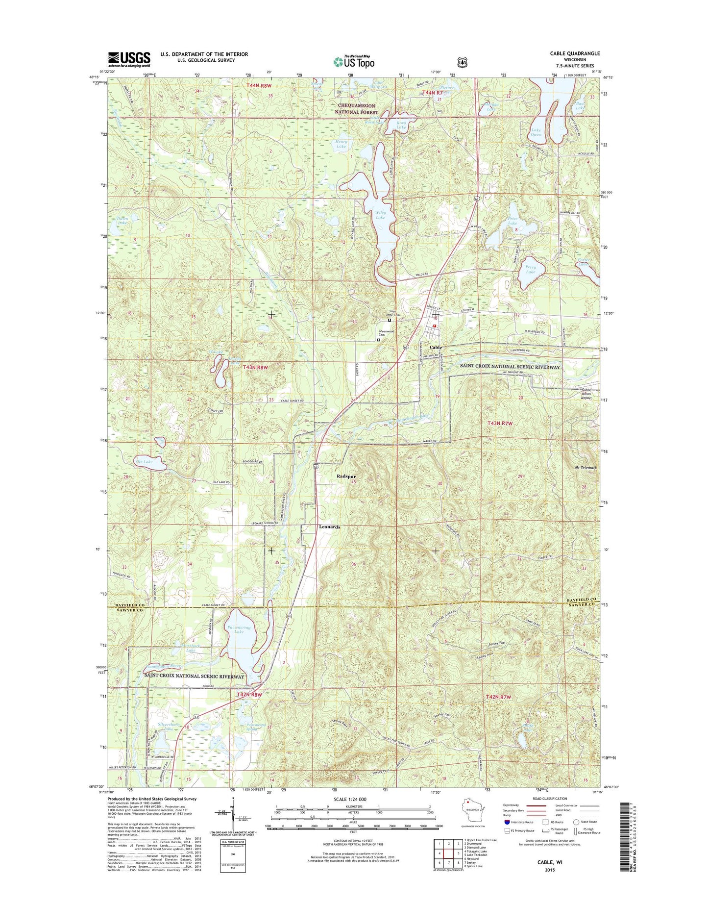
Cable Wisconsin US Topo Map
Couldn't load pickup availability
Also explore the Cable Forest Service Topo of this same quad for updated USFS data
2022 topographic map quadrangle Cable in the state of Wisconsin. Scale: 1:24000. Based on the newly updated USGS 7.5' US Topo map series, this map is in the following counties: Bayfield, Sawyer. The map contains contour data, water features, and other items you are used to seeing on USGS maps, but also has updated roads and other features. This is the next generation of topographic maps. Printed on high-quality waterproof paper with UV fade-resistant inks.
Quads adjacent to this one:
West: Totagatic Lake
Northwest: Upper Eau Claire Lake
North: Drummond
Northeast: Diamond Lake
East: Lake Tahkodah
Southeast: Spider Lake
South: Seeley
Southwest: Hayward
This map covers the same area as the classic USGS quad with code o46091b3.
Contains the following named places: Bass Lake, Big Brook, Cable, Cable Census Designated Place, Cable Lake, Cable Post Office, Cable Volunteer Fire Department, Dawn Lake, Great Divide Ambulance Service, Greenwood Cemetery, Henry Lake, Leonards, Lerche Lake, Little Rosa Lake, Mossback Lake, Motyka Lake, Mount Telemark, Mount Telemark Winter Sports Area, Ole Lake, Pacwawong Lake, Pacwawong Spring, Perry Lake, Philadelphia Biblical University - Wisconsin Wilderness, Picture Lake, Porter Lakes, Price Lake, Radspur, Rosa Lake, Saint Anne Cemetery, Seeley Lookout Tower, Silverthorn Lake, Smear Lake, Smith Lake, Telemark Ski Area, Town of Cable, West Lake, Wiley Lake