MyTopo
Loyal West Wisconsin US Topo Map
Couldn't load pickup availability
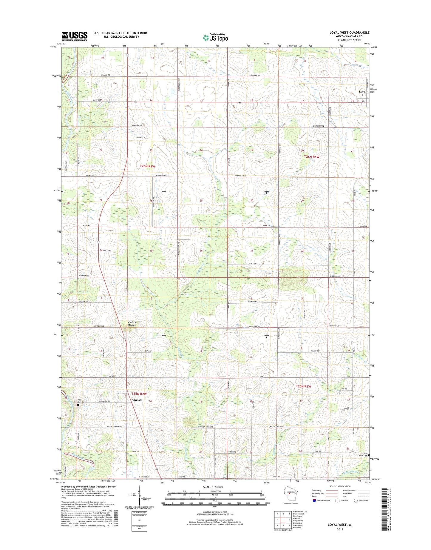
2018 topographic map quadrangle Loyal West in the state of Wisconsin. Scale: 1:24000. Based on the newly updated USGS 7.5' US Topo map series, this map is in the following counties: Clark. The map contains contour data, water features, and other items you are used to seeing on USGS maps, but also has updated roads and other features. This is the next generation of topographic maps. Printed on high-quality waterproof paper with UV fade-resistant inks.
Quads adjacent to this one:
West: Willard
Northwest: Mead Lake East
North: Greenwood
Northeast: Riplinger
East: Loyal East
Southeast: Granton
South: Neillsville
Southwest: Columbia
Contains the following named places: Christie, Christie Mound, Clark County, East Side Cemetery, Eaton Center School, Forman School, Lincoln School, Lion School, Loyal Elementary School, Loyal Junior - Senior High School, Loyal Junior High School, Loyal Wastewater Treatment Facility, Marie Louise Chapel, Mound School, Oriole Hill School, Pleasant View School, Prosperity School, Ross School, Town of Eaton, Town of Weston, York Center Cemetery, York Center Church