MyTopo
Greenwood Wisconsin US Topo Map
Couldn't load pickup availability
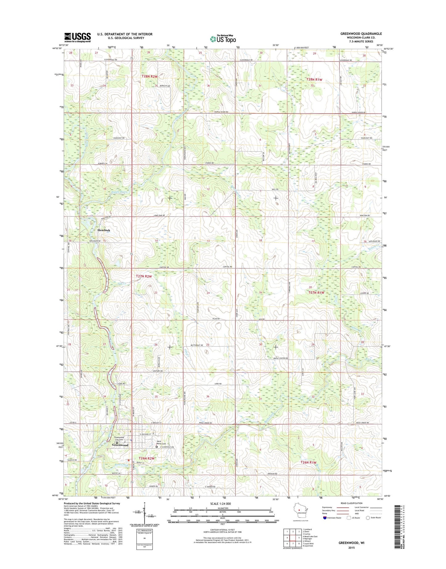
2022 topographic map quadrangle Greenwood in the state of Wisconsin. Scale: 1:24000. Based on the newly updated USGS 7.5' US Topo map series, this map is in the following counties: Clark. The map contains contour data, water features, and other items you are used to seeing on USGS maps, but also has updated roads and other features. This is the next generation of topographic maps. Printed on high-quality waterproof paper with UV fade-resistant inks.
Quads adjacent to this one:
West: Mead Lake East
Northwest: Lombard
North: Owen
Northeast: Curtiss
East: Riplinger
Southeast: Loyal East
South: Loyal West
Southwest: Willard
This map covers the same area as the classic USGS quad with code o44090g5.
Contains the following named places: Bear Creek, Behringer Creek, Christopherson School, City of Greenwood, Gile Creek, Grace United Methodist Church, Greenwood, Greenwood Area Volunteer Fire Department / Greenwood Area Ambulance Service, Greenwood City Cemetery, Greenwood Elementary School, Greenwood Middle / High School, Greenwood Park, Greenwood Police Department, Greenwood Post Office, Hemlock, LaTart School, Maple Center School, Nelson Creek, Our Saviours Lutheran Church, Popple River, Rock Creek, Saint Mary School, Saint Marys Cemetery, Town Line Airport, Town of Warner, Trondjem Church, West Beaver Church