MyTopo
Mead Lake East Wisconsin US Topo Map
Couldn't load pickup availability
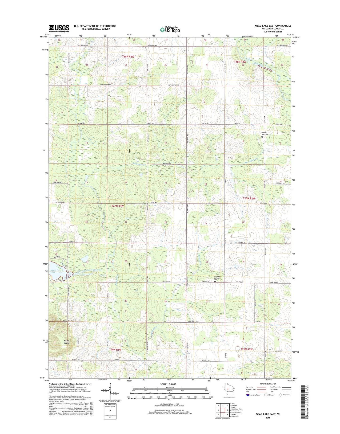
2022 topographic map quadrangle Mead Lake East in the state of Wisconsin. Scale: 1:24000. Based on the newly updated USGS 7.5' US Topo map series, this map is in the following counties: Clark. The map contains contour data, water features, and other items you are used to seeing on USGS maps, but also has updated roads and other features. This is the next generation of topographic maps. Printed on high-quality waterproof paper with UV fade-resistant inks.
Quads adjacent to this one:
West: Mead Lake West
Northwest: Thorp
North: Lombard
Northeast: Owen
East: Greenwood
Southeast: Loyal West
South: Willard
Southwest: Rock Dam Lake
This map covers the same area as the classic USGS quad with code o44090g6.
Contains the following named places: 0.3 Reservoir, 54437, Benjamin School, Braun Settlement School, Breezeway School, Brown Church, Decker School, Forest Hill Cemetery, Immanuel Church, Immanuel Lutheran Cemetery, Kokaly Lookout Tower, Meadow View Amish School, Mech G4583 Dam, North Mound, Norwegian Creek, Oakland School, Pleasant View Amish School, Rocky Run, Rocky Run School, Town of Mead