MyTopo
Riplinger Wisconsin US Topo Map
Couldn't load pickup availability
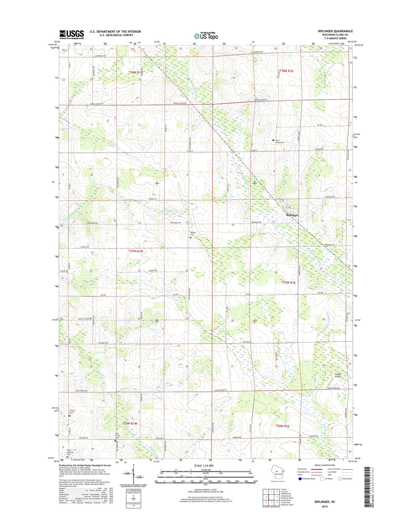
2022 topographic map quadrangle Riplinger in the state of Wisconsin. Scale: 1:24000. Based on the newly updated USGS 7.5' US Topo map series, this map is in the following counties: Clark. The map contains contour data, water features, and other items you are used to seeing on USGS maps, but also has updated roads and other features. This is the next generation of topographic maps. Printed on high-quality waterproof paper with UV fade-resistant inks.
Quads adjacent to this one:
West: Greenwood
Northwest: Owen
North: Curtiss
Northeast: Abbotsford
East: Spencer North
Southeast: Spencer South
South: Loyal East
Southwest: Loyal West
This map covers the same area as the classic USGS quad with code o44090g4.
Contains the following named places: Beaver Cemetery, Beaver Center School, Cloverdale School, East Fork Popple River, Elmwood School, Oak Grove School, Pine Grove Cemetery, Riplinger, Saint Johns Cemetery, Saint Lukes Church, Stoiber Airport, Sunny Knoll School, Sunnyside School, Sunshine School, Taft School, Town of Beaver, Town of Unity, Trinity Cemetery