MyTopo
Willard Wisconsin US Topo Map
Couldn't load pickup availability
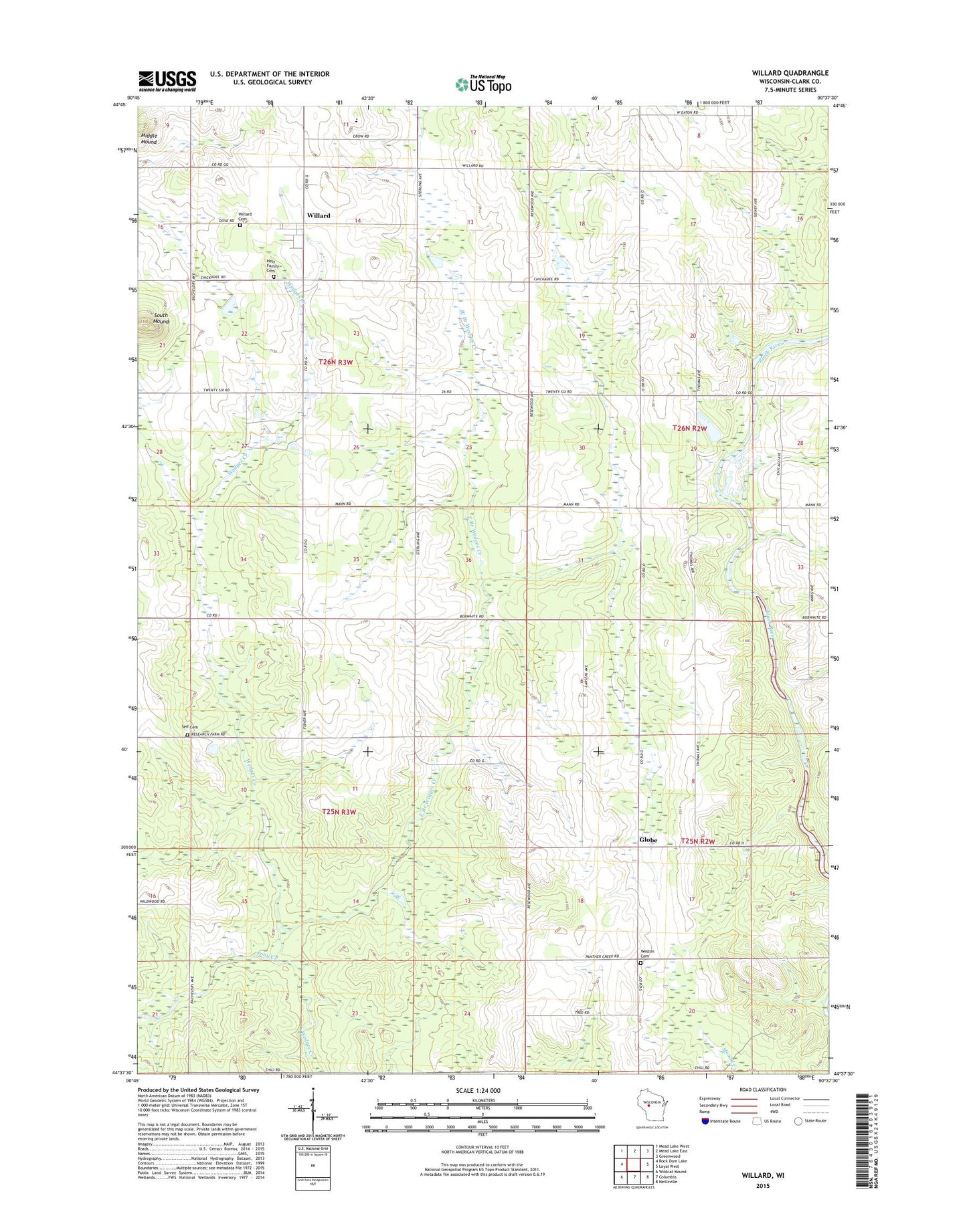
2022 topographic map quadrangle Willard in the state of Wisconsin. Scale: 1:24000. Based on the newly updated USGS 7.5' US Topo map series, this map is in the following counties: Clark. The map contains contour data, water features, and other items you are used to seeing on USGS maps, but also has updated roads and other features. This is the next generation of topographic maps. Printed on high-quality waterproof paper with UV fade-resistant inks.
Quads adjacent to this one:
West: Rock Dam Lake
Northwest: Mead Lake West
North: Mead Lake East
Northeast: Greenwood
East: Loyal West
Southeast: Neillsville
South: Columbia
Southwest: Wildcat Mound
This map covers the same area as the classic USGS quad with code o44090f6.
Contains the following named places: East Branch Wedges Creek, Fairview School, Globe, Holy Family Cemetery, Janesville School, Middle Mound, North Hendren Amish School, Pony Creek, Seif Cemetery, South Mound, Town of Hendren, Town of Seif, West Eaton School, West Weston Cemetery, Willard, Willard Cemetery, Willard Post Office, Worchel School