MyTopo
Marathon SW Wisconsin US Topo Map
Couldn't load pickup availability
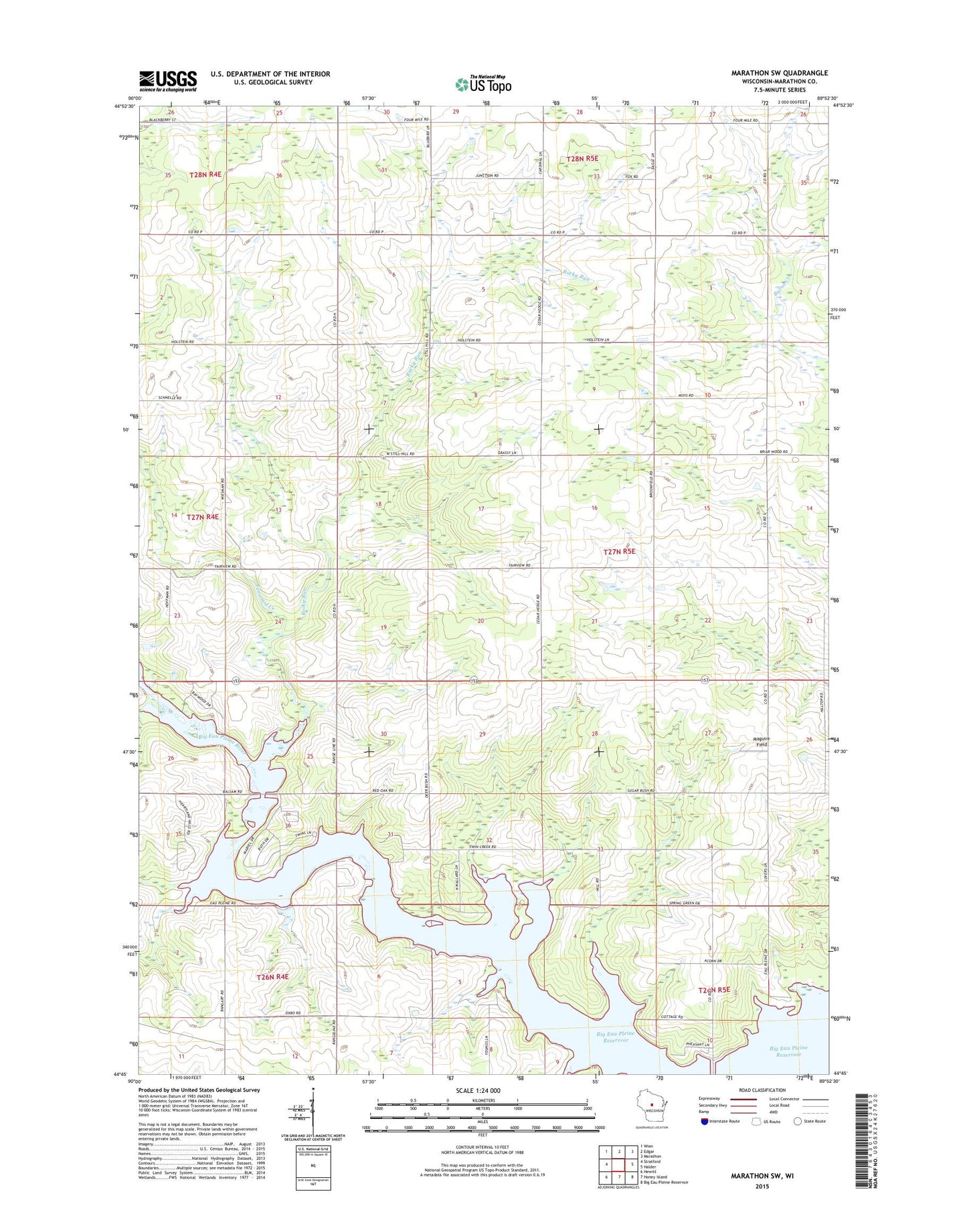
2022 topographic map quadrangle Marathon SW in the state of Wisconsin. Scale: 1:24000. Based on the newly updated USGS 7.5' US Topo map series, this map is in the following counties: Marathon. The map contains contour data, water features, and other items you are used to seeing on USGS maps, but also has updated roads and other features. This is the next generation of topographic maps. Printed on high-quality waterproof paper with UV fade-resistant inks.
Quads adjacent to this one:
West: Stratford
Northwest: Wien
North: Edgar
Northeast: Marathon
East: Halder
Southeast: Big Eau Pleine Reservoir
South: Honey Island
Southwest: Hewitt
This map covers the same area as the classic USGS quad with code o44089g8.
Contains the following named places: Baumann Dairy Farms, Big Eau Pleine Reservoir, Fenwood Creek, Kaisers Jersey Farm, Ludington School, Maguire Field, Quiet Acres, Rock Ridge Orchard, Rocky Run, Sunshine School, Town of Emmet, Willies School