MyTopo
Honey Island Wisconsin US Topo Map
Couldn't load pickup availability
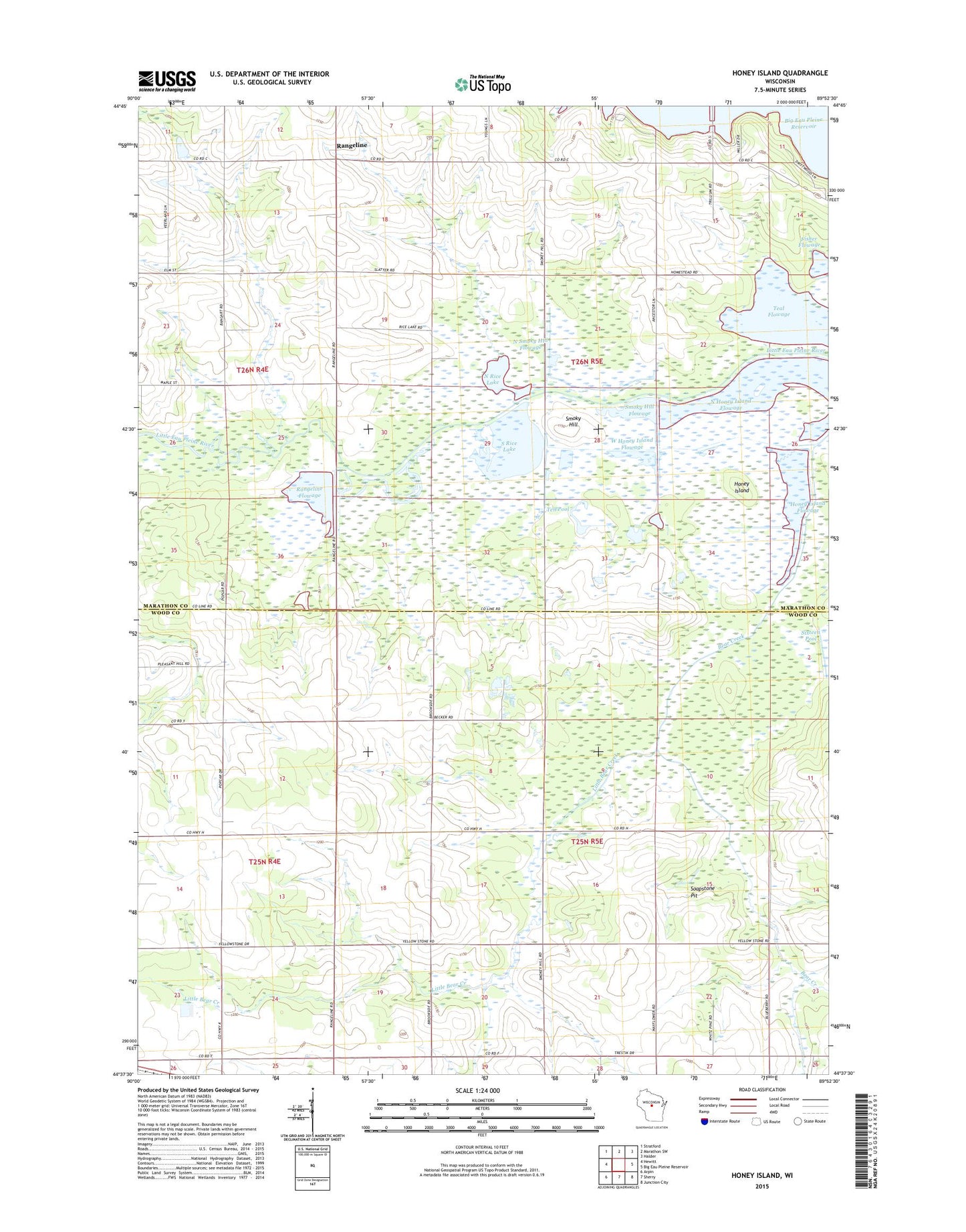
2022 topographic map quadrangle Honey Island in the state of Wisconsin. Scale: 1:24000. Based on the newly updated USGS 7.5' US Topo map series, this map is in the following counties: Marathon, Wood. The map contains contour data, water features, and other items you are used to seeing on USGS maps, but also has updated roads and other features. This is the next generation of topographic maps. Printed on high-quality waterproof paper with UV fade-resistant inks.
Quads adjacent to this one:
West: Hewitt
Northwest: Stratford
North: Marathon SW
Northeast: Halder
East: Big Eau Pleine Reservoir
Southeast: Junction City
South: Sherry
Southwest: Arpin
This map covers the same area as the classic USGS quad with code o44089f8.
Contains the following named places: Bear Creek, Beth Arthur Lane Pond Number 3, Brandt Farm, Carey School, Fisher Flowage, Grace Church, Honey Island, Honey Island Flowage, Little Bear Creek, McKinley School, North Honey Island Flowage, North Rice Lake, North Smoky Hill Flowage, Phillip School, Rangeline, Rangeline Flowage, Sixteen Pool, Smoky Hill, Smoky Hill Flowage, Soapstone Pit, South Rice Lake, Sunshine School, Teal Flowage, Ten Pool, Town of Green Valley, Town of Milladore, West Honey Island Flowage, ZIP Code: 54412