MyTopo
Halder Wisconsin US Topo Map
Couldn't load pickup availability
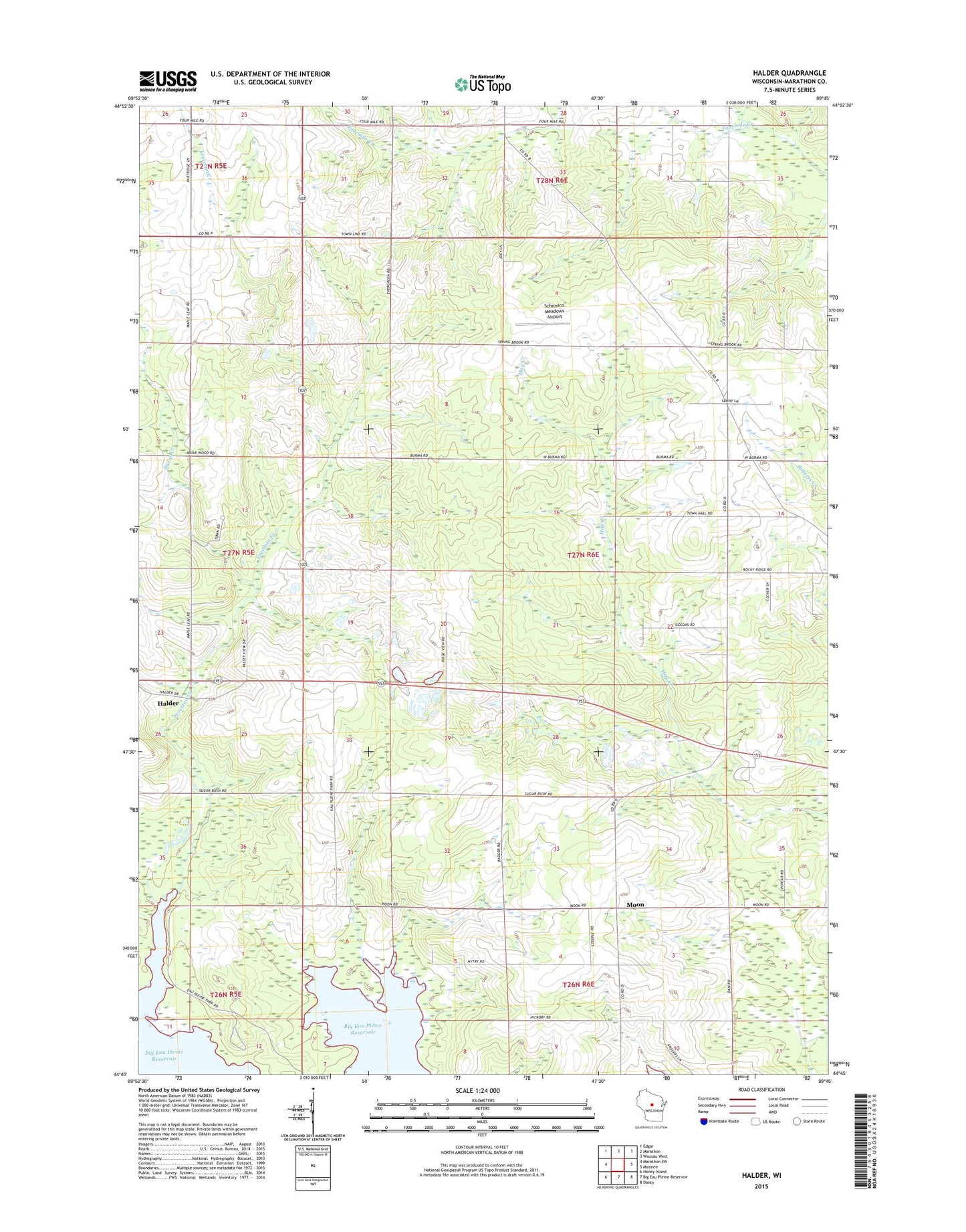
2022 topographic map quadrangle Halder in the state of Wisconsin. Scale: 1:24000. Based on the newly updated USGS 7.5' US Topo map series, this map is in the following counties: Marathon. The map contains contour data, water features, and other items you are used to seeing on USGS maps, but also has updated roads and other features. This is the next generation of topographic maps. Printed on high-quality waterproof paper with UV fade-resistant inks.
Quads adjacent to this one:
West: Marathon SW
Northwest: Edgar
North: Marathon
Northeast: Wausau West
East: Mosinee
Southeast: Dancy
South: Big Eau Pleine Reservoir
Southwest: Honey Island
This map covers the same area as the classic USGS quad with code o44089g7.
Contains the following named places: Burns Creek, Daul Dairy Farm, Freeman Creek, Freeman Creek Farms, Gottschalk Quarry, Grabow Farms, Granite Hill School, Halder, K and S Dairy Farm, Ladick and Belanger Quarry, Ladick Quarry, Moon, Oleson School, Rocky Ridge School, Saint Patricks Church, Saint Roberts School, Scherrico Meadows Airport, Stubbe Farm, Town of Mosinee, Wind Valley Farms