MyTopo
Marsh-Miller Lake Wisconsin US Topo Map
Couldn't load pickup availability
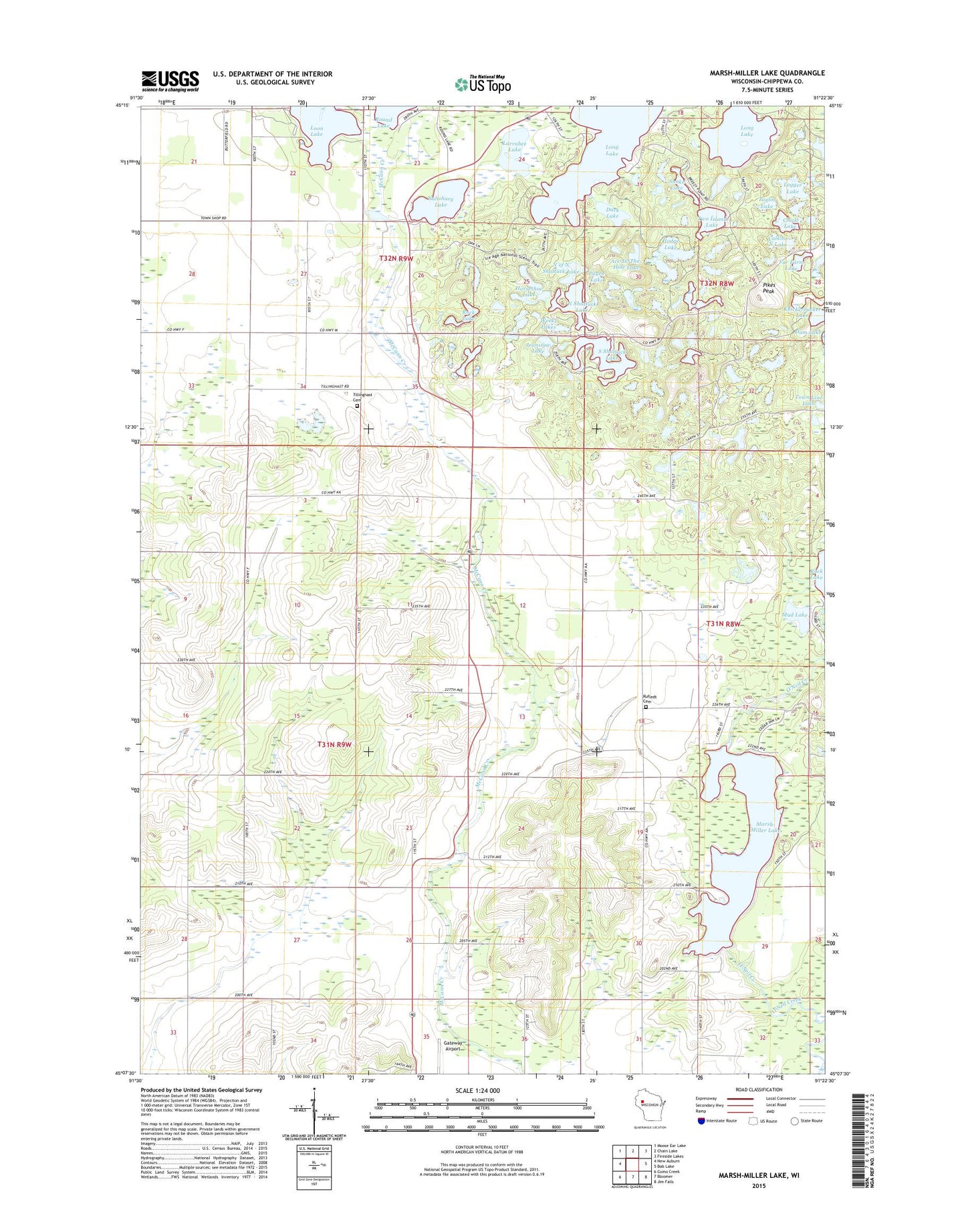
2022 topographic map quadrangle Marsh-Miller Lake in the state of Wisconsin. Scale: 1:24000. Based on the newly updated USGS 7.5' US Topo map series, this map is in the following counties: Chippewa. The map contains contour data, water features, and other items you are used to seeing on USGS maps, but also has updated roads and other features. This is the next generation of topographic maps. Printed on high-quality waterproof paper with UV fade-resistant inks.
Quads adjacent to this one:
West: New Auburn
Northwest: Moose Ear Lake
North: Chain Lake
Northeast: Fireside Lakes
East: Bob Lake
Southeast: Jim Falls
South: Bloomer
Southwest: Como Creek
This map covers the same area as the classic USGS quad with code o45091b4.
Contains the following named places: Ace-In-The-Hole Lake, Bloomer Townhall, Calkins North Lake, Camp Chippewa Bay, Camp Manitou, Camp Norwesco, Camp Pokonokah Hills, Chick Lake, Church of God, Dark Lake, Elmhurst School, Fernwood School, Fur Farm Lake, Gunderson Farms, Hansons 2WP792 Dam, Herde Lake, Hodge Lake, Horseshoe Lake, Ice Age National Scientific Reserve, Jeanstow Lake, Knickerbocker Lake, Lakeland Airport, Larrabee Lake, Logger Lake, Loon Lake, Marsh-Miller Lake, Marsh-Miller Lake 16, Mud Lake, North of North Shattuck Lake, North Shattuck Lake, Payne Lake, Pikes Peak, Pine Corner School, Pine Grove School, Rock Lake, Roger Lake Number Two, Rufledt Cemetery, Salisbury Lake, Sampson Townhall, Skaw Farm, Snake Lake, South Shattuck Lake, Taylor Lake, Tillinghast Cemetery, Tillinghast School, Town of Bloomer, Town of Sampson, Trout Creek School, Two Island Lake, Weeks Lakes