MyTopo
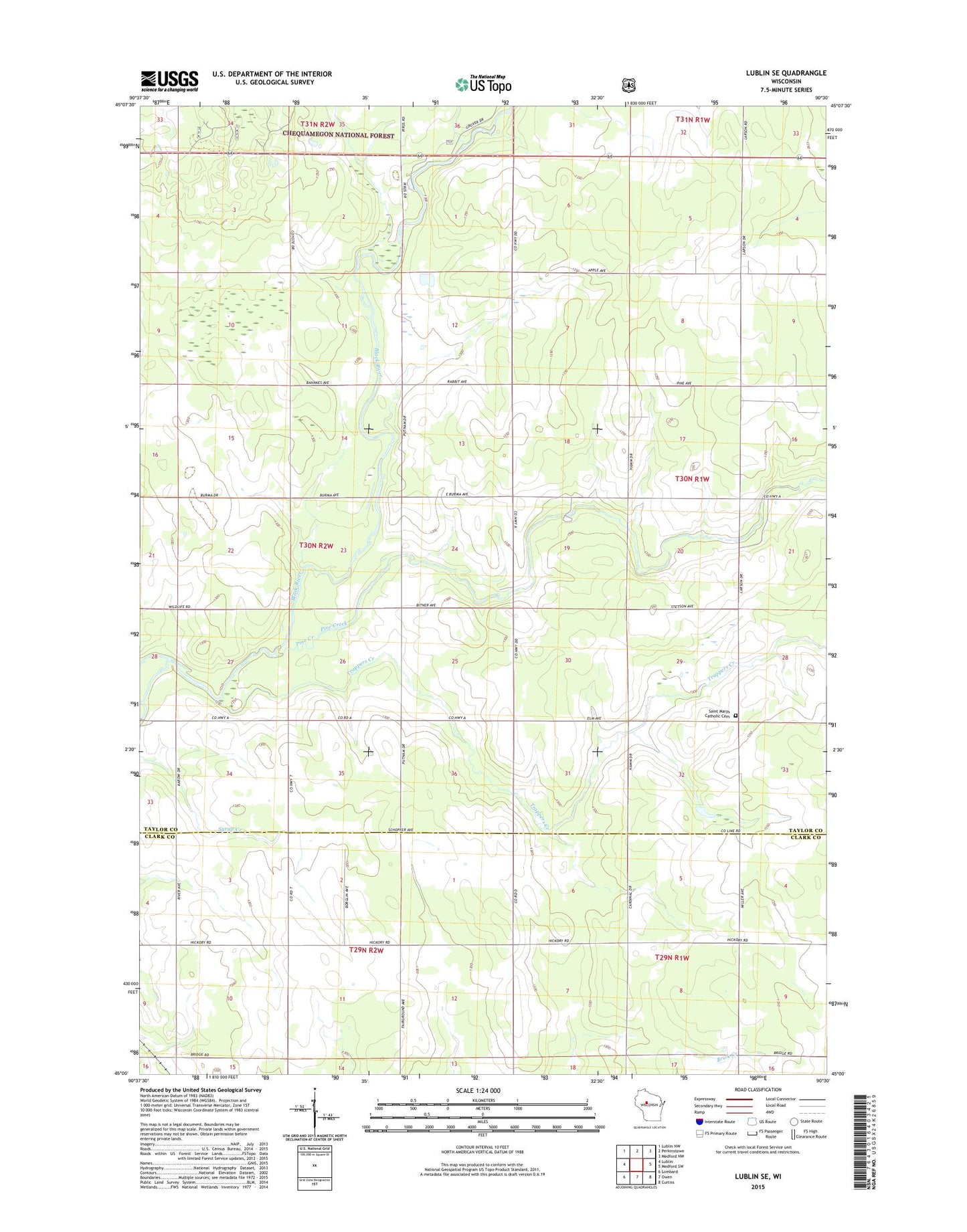
Lublin SE Wisconsin US Topo Map
Couldn't load pickup availability
Also explore the Lublin SE Forest Service Topo of this same quad for updated USFS data
2022 topographic map quadrangle Lublin SE in the state of Wisconsin. Scale: 1:24000. Based on the newly updated USGS 7.5' US Topo map series, this map is in the following counties: Taylor, Clark. The map contains contour data, water features, and other items you are used to seeing on USGS maps, but also has updated roads and other features. This is the next generation of topographic maps. Printed on high-quality waterproof paper with UV fade-resistant inks.
Quads adjacent to this one:
West: Lublin
Northwest: Lublin NW
North: Perkinstown
Northeast: Medford NW
East: Medford SW
Southeast: Curtiss
South: Owen
Southwest: Lombard
This map covers the same area as the classic USGS quad with code o45090a5.
Contains the following named places: Elmhurst School, Forest Grove School, Joe Creek, Larson School, Maplehurst Townhall, Pine Creek, Pine Creek School, Poplar Grove School, Redville School, Riverside School, Saint Marys Catholic Cemetery, Saint Marys Church, Town of Maplehurst, Trappers Creek, White School