MyTopo
Dunn Lake Wisconsin US Topo Map
Couldn't load pickup availability
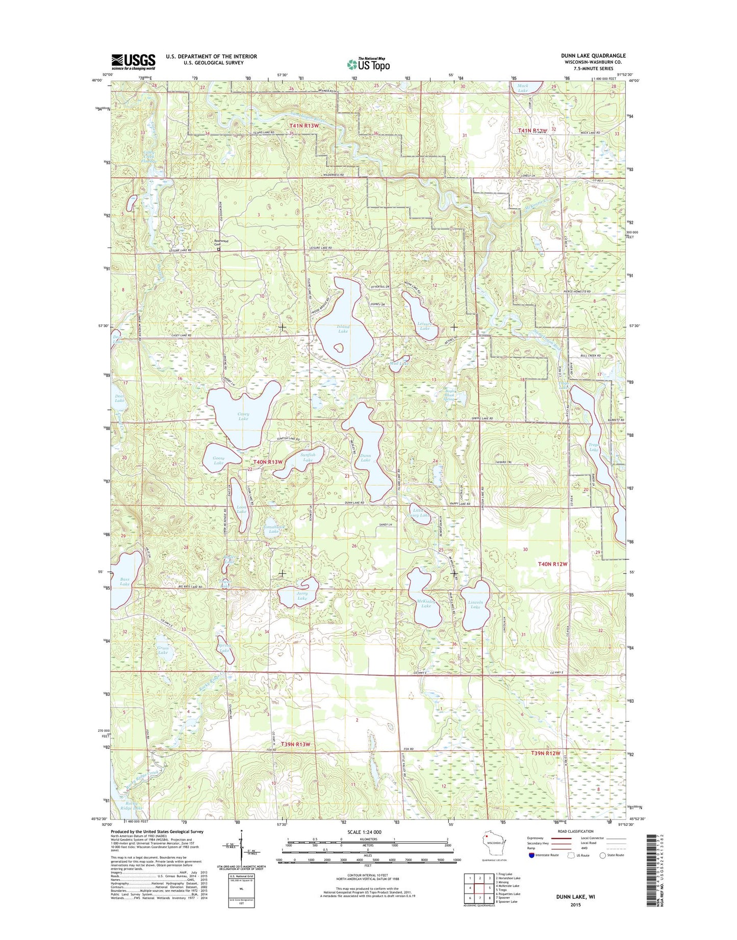
2022 topographic map quadrangle Dunn Lake in the state of Wisconsin. Scale: 1:24000. Based on the newly updated USGS 7.5' US Topo map series, this map is in the following counties: Washburn. The map contains contour data, water features, and other items you are used to seeing on USGS maps, but also has updated roads and other features. This is the next generation of topographic maps. Printed on high-quality waterproof paper with UV fade-resistant inks.
Quads adjacent to this one:
West: McKenzie Lake
Northwest: Frog Lake
North: Horseshoe Lake
Northeast: Minong
East: Trego
Southeast: Spooner Lake
South: Spooner
Southwest: Poquettes Lake
This map covers the same area as the classic USGS quad with code o45091h8.
Contains the following named places: Bass Lake, Boyle Brook, Boyle Brook Spring, Casey Creek Flowage, Casey Lake, Conroy Ford 3WR374 Dam, Dunn Lake, Goose Lake, Grass Lake, Island Lake, Jerry Lake, Leisure Lake, Lincoln Lake, Little Casey Lake, Loon Lake, McKenzie Creek, McKenzie Creek State Public Fishery Area, McKinley Lake, Mud Lake, Rappy Lake, Rigler Lake, Rocky Ridge Creek, Rocky Ridge Lake, Rosewood Cemetery, Schulze-Spooner Airport, Spring Lake, Sunfish Lake, Tadpole Corners, Tomahawk Lake, Tower Lake, Town of Casey, Trego Dam, Trego Hydro Generating Station, Trego Lake, Trego WP220 Dam, Washburn County Youth Camp, ZIP Code: 54801