MyTopo
Mount Tom Wisconsin US Topo Map
Couldn't load pickup availability
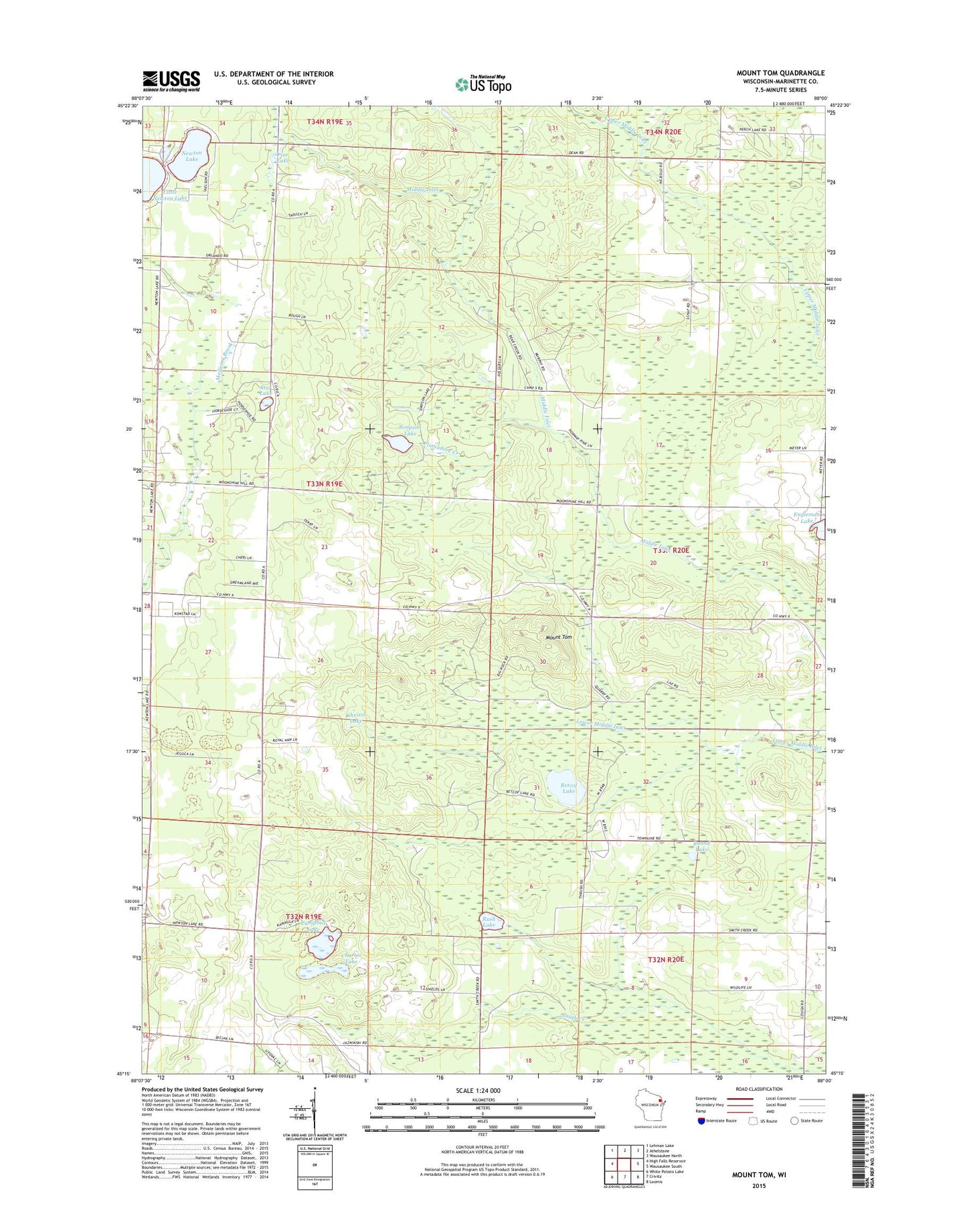
2018 topographic map quadrangle Mount Tom in the state of Wisconsin. Scale: 1:24000. Based on the newly updated USGS 7.5' US Topo map series, this map is in the following counties: Marinette. The map contains contour data, water features, and other items you are used to seeing on USGS maps, but also has updated roads and other features. This is the next generation of topographic maps. Printed on high-quality waterproof paper with UV fade-resistant inks.
Quads adjacent to this one:
West: High Falls Reservoir
Northwest: Lehman Lake
North: Athelstane
Northeast: Wausaukee North
East: Wausaukee South
Southeast: Loomis
South: Crivitz
Southwest: White Potato Lake
Contains the following named places: Brookdale School, Campbell Lake, Campbell School, Charles Lake, Chrizel Lake, Konsted School, Little Newton Lake, Marinette County, Mount Tom, Mount Tom Fire Tower, Newton Lake, Newton Lakes School, Pine Lake, Plumadore Creek, Retcof Lake, Round Lake, Rush Lake, Simpson Lake, Star Lake, Sundown Golf Course, Vanderbloomer School