
MyTopo
Nekoosa Wisconsin US Topo Map
Couldn't load pickup availability
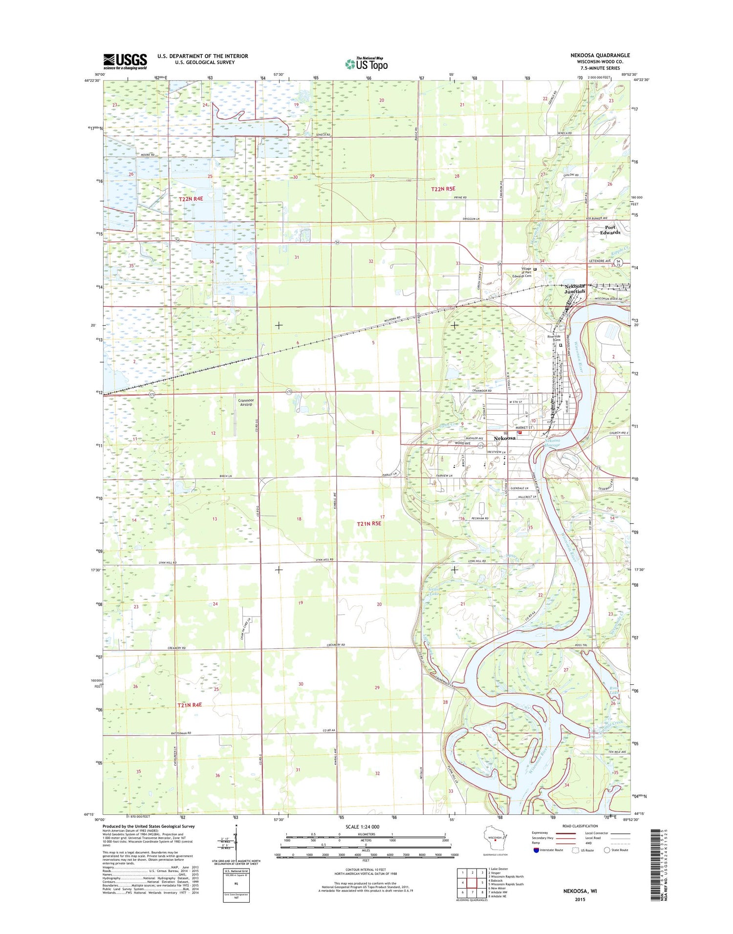
2018 topographic map quadrangle Nekoosa in the state of Wisconsin. Scale: 1:24000. Based on the newly updated USGS 7.5' US Topo map series, this map is in the following counties: Wood. The map contains contour data, water features, and other items you are used to seeing on USGS maps, but also has updated roads and other features. This is the next generation of topographic maps. Printed on high-quality waterproof paper with UV fade-resistant inks.
Quads adjacent to this one:
West: Babcock
Northwest: Lake Dexter
North: Vesper
Northeast: Wisconsin Rapids North
East: Wisconsin Rapids South
Southeast: Arkdale NE
South: Arkdale NW
Southwest: New Miner
Contains the following named places: 11 Reservoir, 14 Reservoir, Alexander Middle School, Arbutus School, Bethlehem Lutheran Church, Ceex Haci, Ceex Haci Census Designated Place, City of Nekoosa, Cranmoor Airstrip, Grass Lake, Green Grove School, Humke Elementary School, Lynn Creek, Moccasin Creek, Nekoosa, Nekoosa Academy, Nekoosa Alternate Charter Middle School, Nekoosa Fire Department, Nekoosa Flowage 5564, Nekoosa High School, Nekoosa Junction, Nekoosa Police Department, Nekoosa Post Office, Nekoosa WP348 Dam, Pine Grove School, Plank Hill School, Ripple Creek, Riverside Cemetery, Riverside Park, Ross Lake, Sacred Heart of Jesus Church, Sacred Heart School, Sevenmile Creek, Tenmile Creek, Town of Port Edwards, Village of Port Edwards Cemetery, WCAE-AM (Nekoosa), Wittenberg School, Wood County 2 C 6118 Dam, Wood County 3 C 6118 Dam


