MyTopo
Lake Dexter Wisconsin US Topo Map
Couldn't load pickup availability
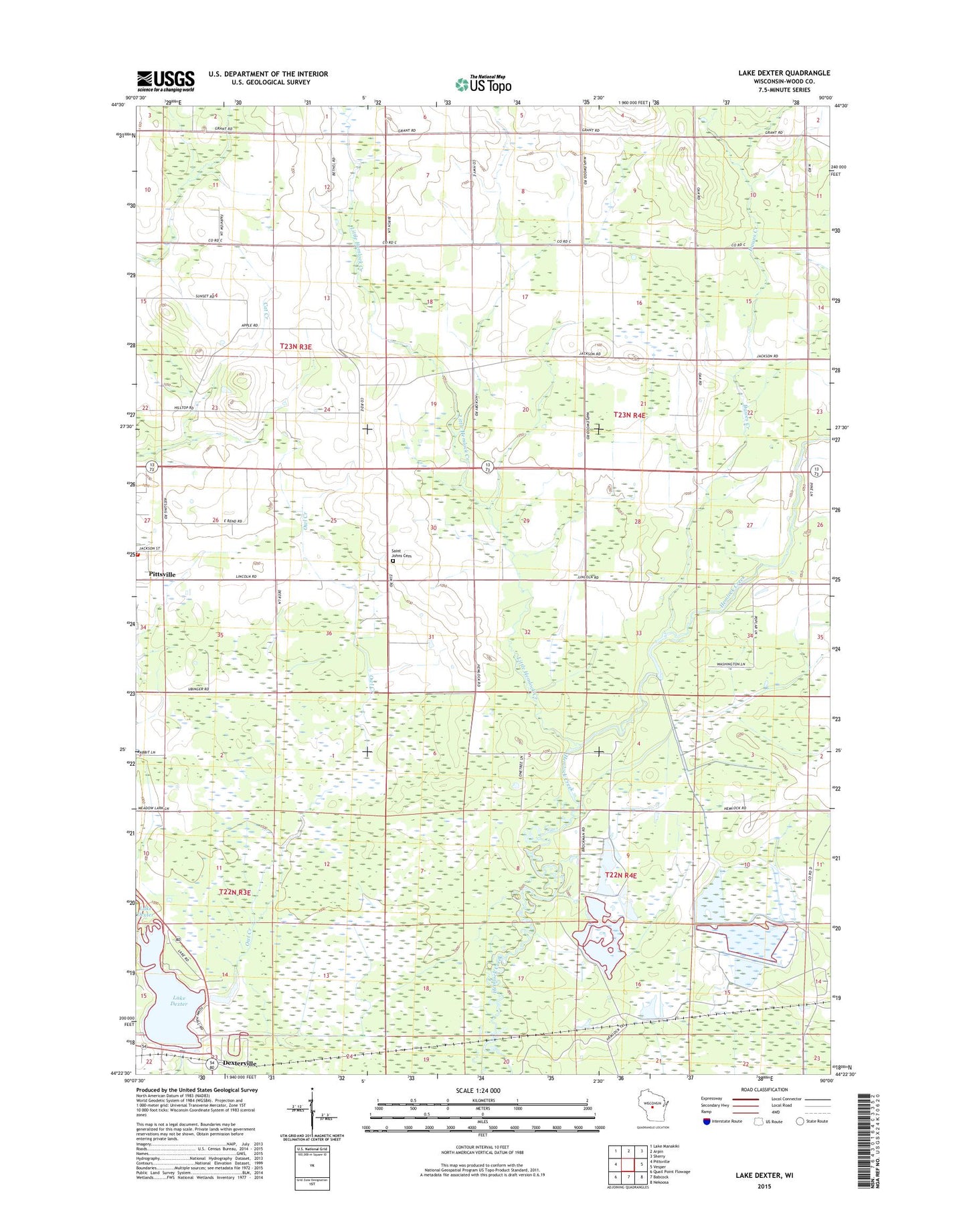
2022 topographic map quadrangle Lake Dexter in the state of Wisconsin. Scale: 1:24000. Based on the newly updated USGS 7.5' US Topo map series, this map is in the following counties: Wood. The map contains contour data, water features, and other items you are used to seeing on USGS maps, but also has updated roads and other features. This is the next generation of topographic maps. Printed on high-quality waterproof paper with UV fade-resistant inks.
Quads adjacent to this one:
West: Pittsville
Northwest: Lake Manakiki
North: Arpin
Northeast: Sherry
East: Vesper
Southeast: Nekoosa
South: Babcock
Southwest: Quail Point Flowage
This map covers the same area as the classic USGS quad with code o44090d1.
Contains the following named places: Dawes Creek, Dexter County Park, Dexterville, Dexterville 2WP1566 Dam, Lake Dexter, Little Hemlock Creek, Natwick School, North Hansen School, Owl Creek, Pittsville, Pittsville Fire Department, Pleasant Valley Cranberry Marsh, Saint Johns Lutheran Cemetery, Town of Hansen, Wood County, ZIP Code: 54489