MyTopo
Vesper Wisconsin US Topo Map
Couldn't load pickup availability
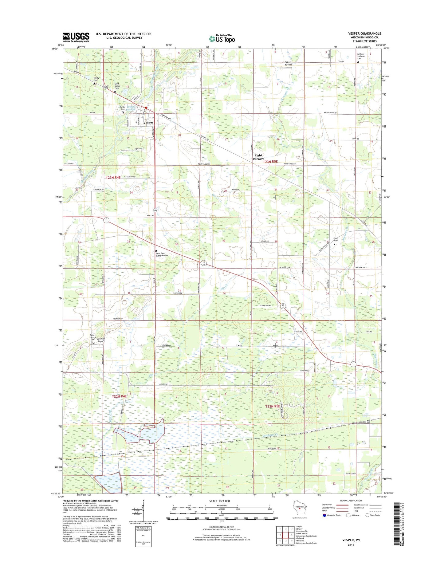
2022 topographic map quadrangle Vesper in the state of Wisconsin. Scale: 1:24000. Based on the newly updated USGS 7.5' US Topo map series, this map is in the following counties: Wood. The map contains contour data, water features, and other items you are used to seeing on USGS maps, but also has updated roads and other features. This is the next generation of topographic maps. Printed on high-quality waterproof paper with UV fade-resistant inks.
Quads adjacent to this one:
West: Lake Dexter
Northwest: Arpin
North: Sherry
Northeast: Junction City
East: Wisconsin Rapids North
Southeast: Wisconsin Rapids South
South: Nekoosa
Southwest: Babcock
This map covers the same area as the classic USGS quad with code o44089d8.
Contains the following named places: Altdorf School, Bean School, Bethany Church, Bethany Lutheran Cemetery, East Fork Hemlock Creek, Eight Corners, Elm Creek, Faith Reformed Church Cemetery, Lone Pine School, Pioneer School, Saint James Catholic Church, Saint James Cemetery, Saint Johns Church, Saint John's Lutheran Cemetery, Saint Joseph Church, Saint Josephs Cemetery, Saint Paul Church, Saint Pauls Lutheran Cemetery, Snyder School, Spring Lake School, Swensen Airport, Town of Seneca, Town of Sigel, Trinity Cemetery, Turner School, Vesper, Vesper Community Academy, Vesper Dam, Vesper Police Department, Vesper Pond 38, Vesper Post Office, Vesper Volunteer Fire Department, Village of Vesper, Walker, Winch Airfield, ZIP Code: 54495