MyTopo
Montello Wisconsin US Topo Map
Couldn't load pickup availability
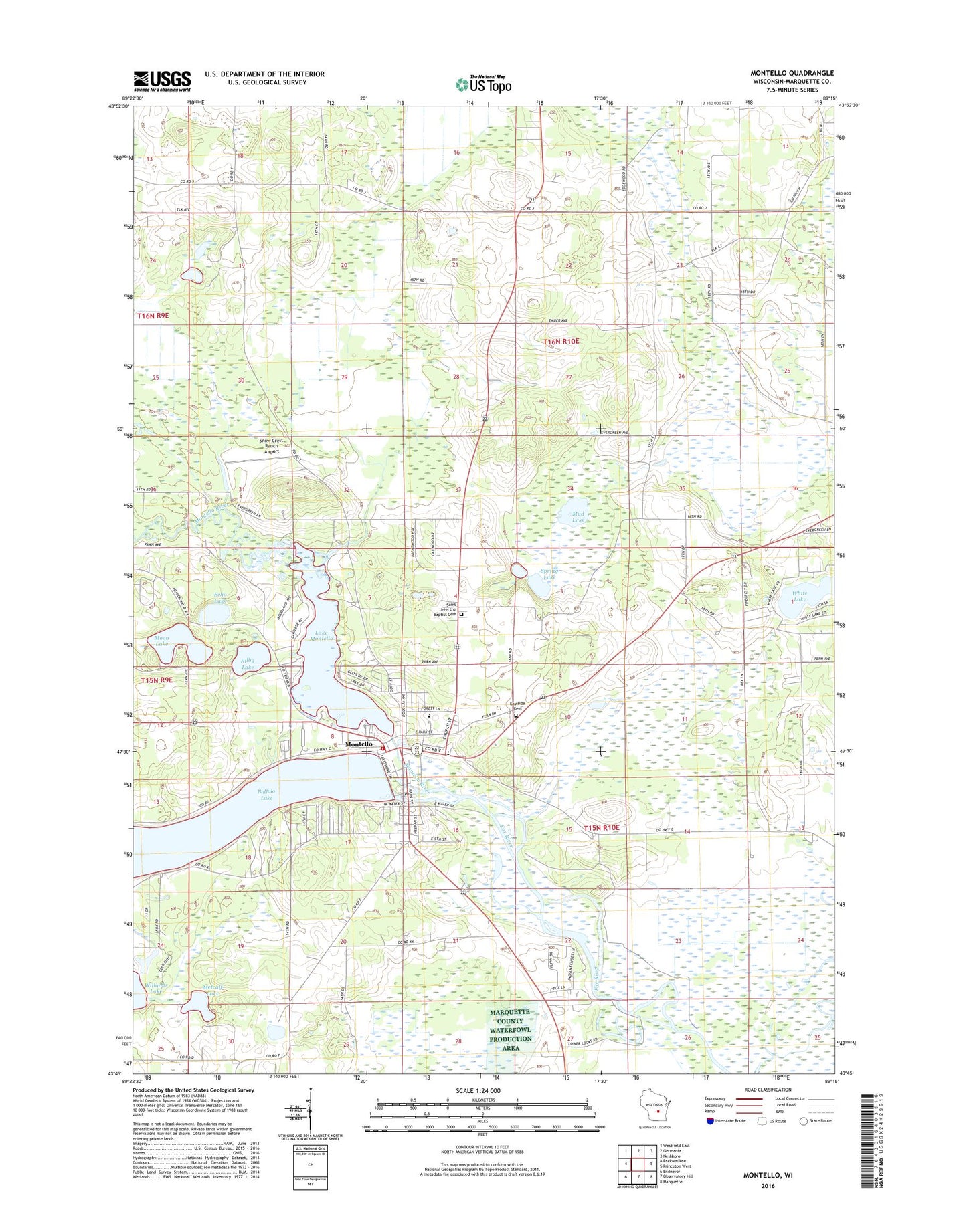
2022 topographic map quadrangle Montello in the state of Wisconsin. Scale: 1:24000. Based on the newly updated USGS 7.5' US Topo map series, this map is in the following counties: Marquette. The map contains contour data, water features, and other items you are used to seeing on USGS maps, but also has updated roads and other features. This is the next generation of topographic maps. Printed on high-quality waterproof paper with UV fade-resistant inks.
Quads adjacent to this one:
West: Packwaukee
Northwest: Westfield East
North: Germania
Northeast: Neshkoro
East: Princeton West
Southeast: Marquette
South: Observatory Hill
Southwest: Endeavor
This map covers the same area as the classic USGS quad with code o43089g3.
Contains the following named places: Buffalo Lake, City of Montello, Cotters Lake, Eastside Cemetery, Echo Lake, Forest Lane Community School, Haney School, Kilby Lake, Krist Island Airport, Lake Montello, Lake Montello 160, Marquette County Emergency Medical Services Montello, Marquette County Jail, Marquette County Sheriff's Office, Marquette County Waterfowl Production Area, Metcalf Lake, Montello, Montello Dam, Montello Fire Department, Montello Granite Dam, Montello Granite Quarry, Montello Junior / Senior High School, Montello Police Department, Montello Post Office, Montello River, Moon Lake, Mud Lake, Myrland Sky Lodge, Rex Ranch Airport, Saint John the Baptist Catholic Church, Saint John the Baptist Cemetery, Saint John's Lutheran School, Sky Lodge Landing Strip, Snow Crest Ranch Airport, Spring Lake, Town of Montello, Town of Shields, White Lake, ZIP Code: 53949