MyTopo
Hegg Wisconsin US Topo Map
Couldn't load pickup availability
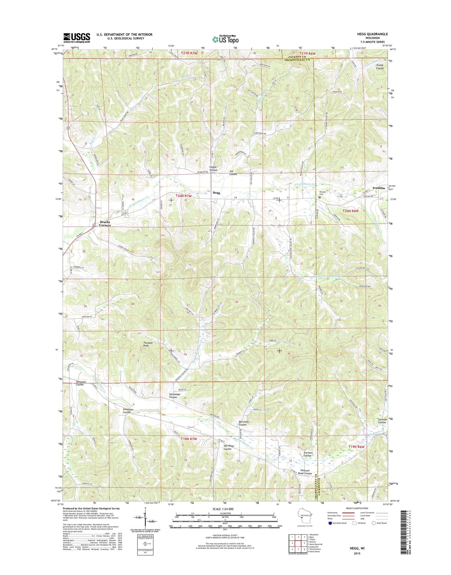
2022 topographic map quadrangle Hegg in the state of Wisconsin. Scale: 1:24000. Based on the newly updated USGS 7.5' US Topo map series, this map is in the following counties: Trempealeau, Jackson. The map contains contour data, water features, and other items you are used to seeing on USGS maps, but also has updated roads and other features. This is the next generation of topographic maps. Printed on high-quality waterproof paper with UV fade-resistant inks.
Quads adjacent to this one:
West: Ettrick
Northwest: Whitehall
North: Blair
Northeast: Taylor
East: North Bend NE
Southeast: North Bend
South: Stevenstown
Southwest: Galesville
This map covers the same area as the classic USGS quad with code o44091b2.
Contains the following named places: Beach School, Beachs Corners, Bear Creek, Borreson Coulee, Buckholz Corners, Columbus Creek, Faith Lutheran Church, German Coulee, Hegg, Hegg School, Joe Coulee, Joe Coulee Creek, Legue Coulee, Lone Star School, North Beaver Creek Lutheran Church, Peacock Road Coulee, Pioneer Cemetery, Salzwedel Coulee, Salzwedel Coulee Creek, Simonson Coulee, South Beaver Creek Church, South Branch School, Stensven Coulee, Svenson Coulee, Thimble Peak, Town of Ettrick, Van Riper Coulee, Washington Coulee Creek, Washington School, West Branch Beaver Creek, Whalen School, ZIP Code: 54627