MyTopo
North Bend NE Wisconsin US Topo Map
Couldn't load pickup availability
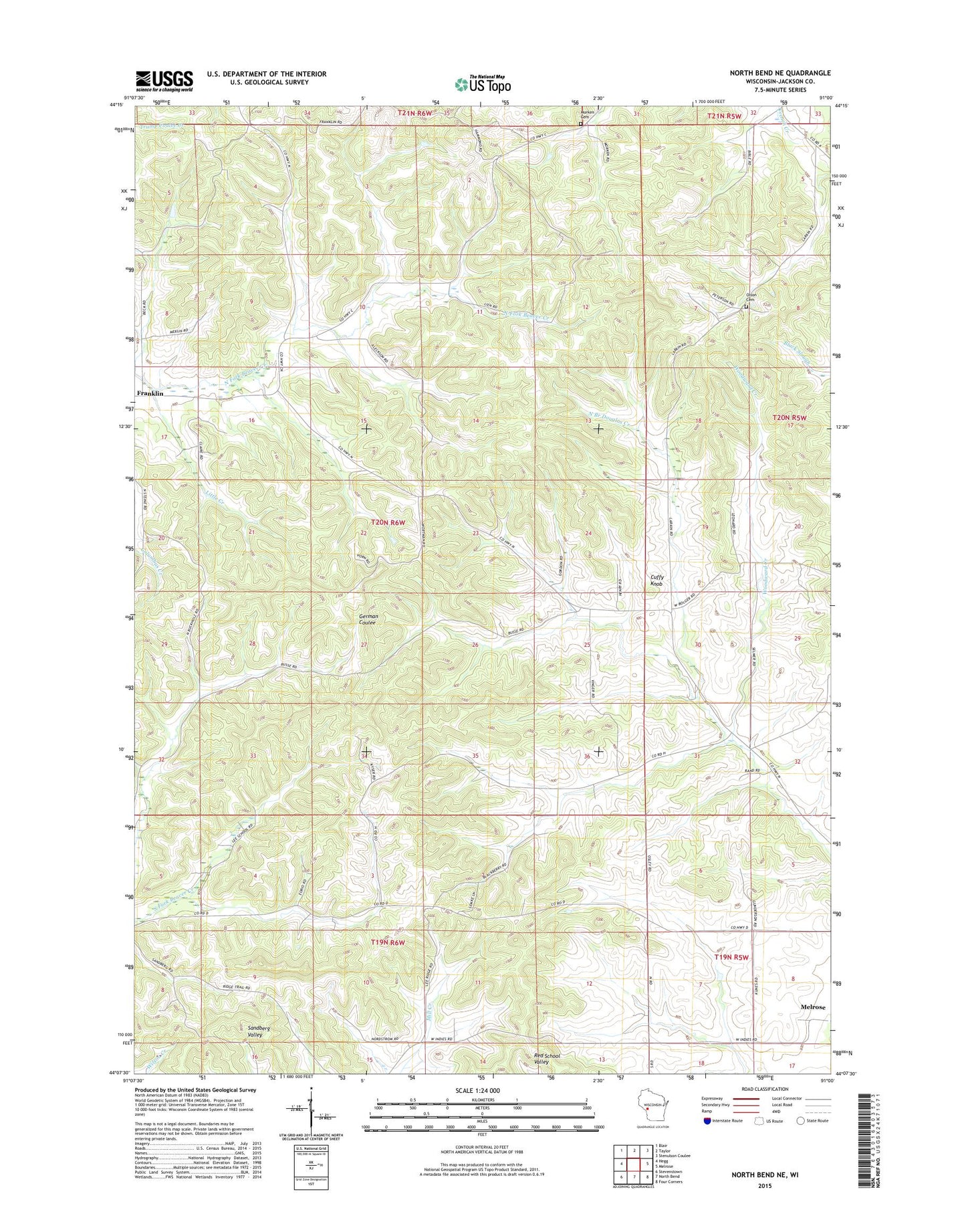
2022 topographic map quadrangle North Bend NE in the state of Wisconsin. Scale: 1:24000. Based on the newly updated USGS 7.5' US Topo map series, this map is in the following counties: Jackson. The map contains contour data, water features, and other items you are used to seeing on USGS maps, but also has updated roads and other features. This is the next generation of topographic maps. Printed on high-quality waterproof paper with UV fade-resistant inks.
Quads adjacent to this one:
West: Hegg
Northwest: Blair
North: Taylor
Northeast: Stenulson Coulee
East: Melrose
Southeast: Four Corners
South: North Bend
Southwest: Stevenstown
This map covers the same area as the classic USGS quad with code o44091b1.
Contains the following named places: Cuffy Knob, Cuffy Knob School, East Franklin School, Franklin, German Coulee School, Grinde School, Highland School, Little Creek, Morken Cemetery, North Branch Douglas Creek, Olson Cemetery, Rogneys, Rose Hill School, Town of Franklin, Upper Beaver Creek Church, West India School, Woodward Creek, ZIP Code: 54642