MyTopo
Ontario Wisconsin US Topo Map
Couldn't load pickup availability
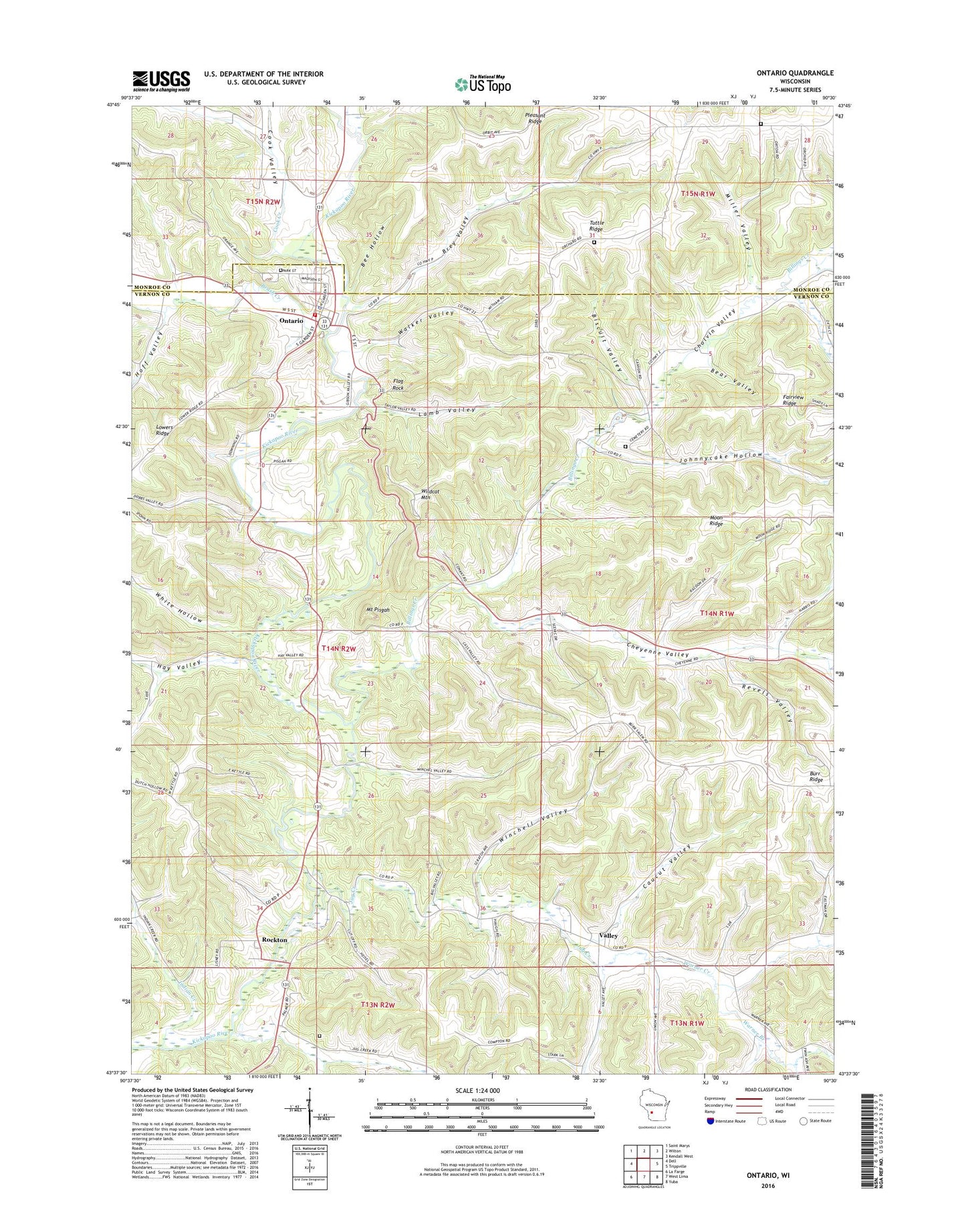
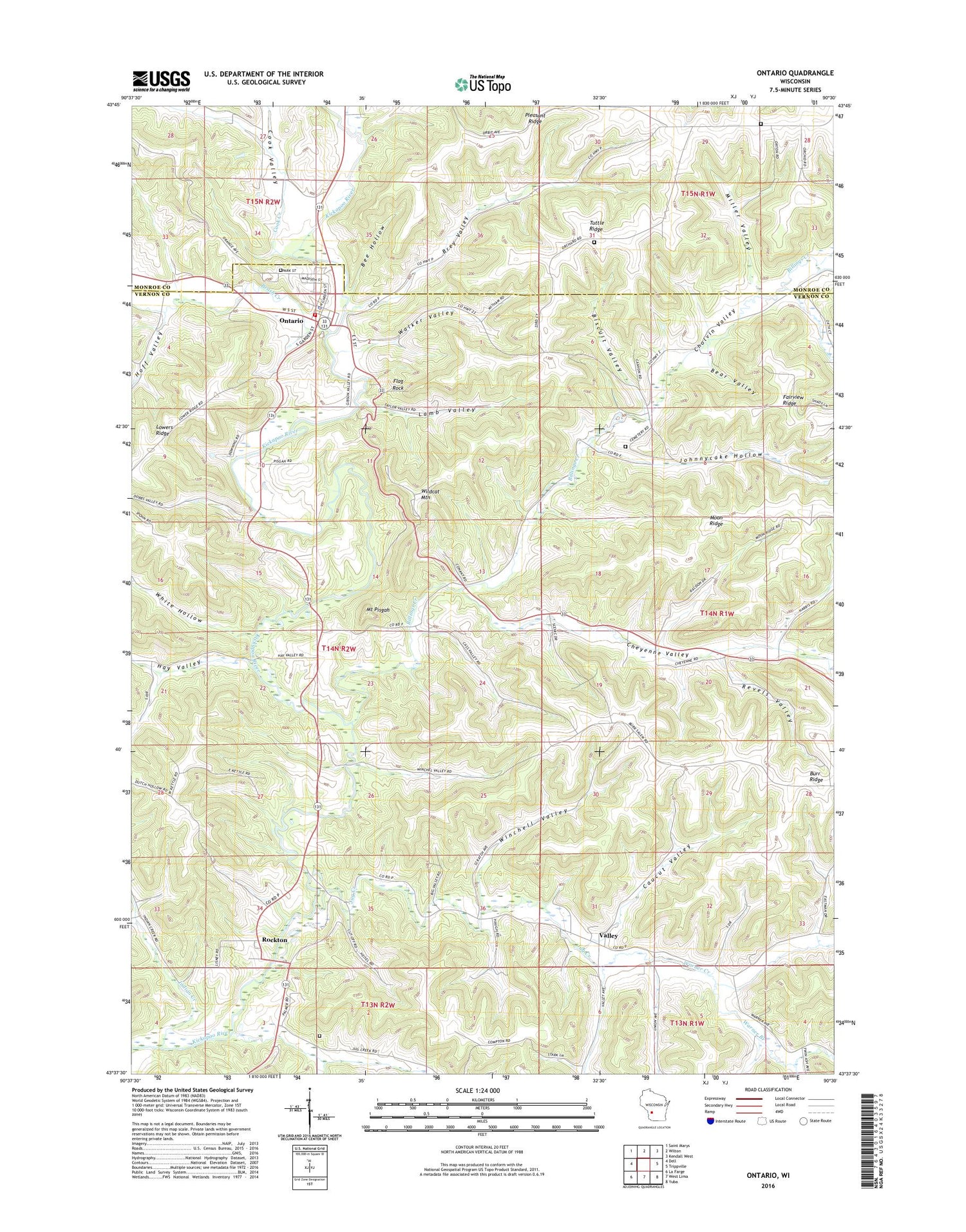
2018 topographic map quadrangle Ontario in the state of Wisconsin. Scale: 1:24000. Based on the newly updated USGS 7.5' US Topo map series, this map is in the following counties: Vernon, Monroe. The map contains contour data, water features, and other items you are used to seeing on USGS maps, but also has updated roads and other features. This is the next generation of topographic maps. Printed on high-quality waterproof paper with UV fade-resistant inks.
Quads adjacent to this one:
West: Dell
Northwest: Saint Marys
North: Wilton
Northeast: Kendall West
East: Trippville
Southeast: Yuba
South: West Lima
Southwest: La Farge
Contains the following named places: Bear Valley, Bee Hollow, Billings Creek, Billings Creek Cemetery, Biscuit Valley, Brey Valley, Brush Creek, Burr Ridge, Cal Day Cemetery, Caucut Valley, Cheyenne Valley, Cholvin Valley, Cook Creek, Cook Valley, Crouch Valley, Eastman School, Fairview Ridge, Flag Rock, Gordon Cemetery, Hay Valley, Hay Valley Creek, Hilltop Rest Cemetery, Hoff Valley, Indian Creek, Johnniecake School, Johnnycake Hollow, Jug Creek, Jug Creek Cemetery, Jug Creek School, Kickapoo Valley Reserve State Natural Area, Lamb Valley, Lowers Ridge, Miller Valley, Moon Ridge, Mount Pisgah, Mount Pisgah Church, Mount Pisgah Hemlock-Hardwoods State Natural Area, Mount Pisgah School, Oden School, Ontario, Ontario Emergency Medical Services, Ontario Fire and Rescue, Ontario Police Department, Ontario Post Office, Pleasant Ridge, Red Brick School, Revels Valley, Rockton, Salem School, South Billings Creek, South Jug Creek, Town of Whitestown, Tuttle Ridge, Valley, Village of Ontario, Walker Valley, Warner Branch, Warner Creek, Wesleyan Church, White Hollow, Wildcat Mountain, Wildcat Mountain State Park, Winchell Valley, ZIP Code: 54651