MyTopo
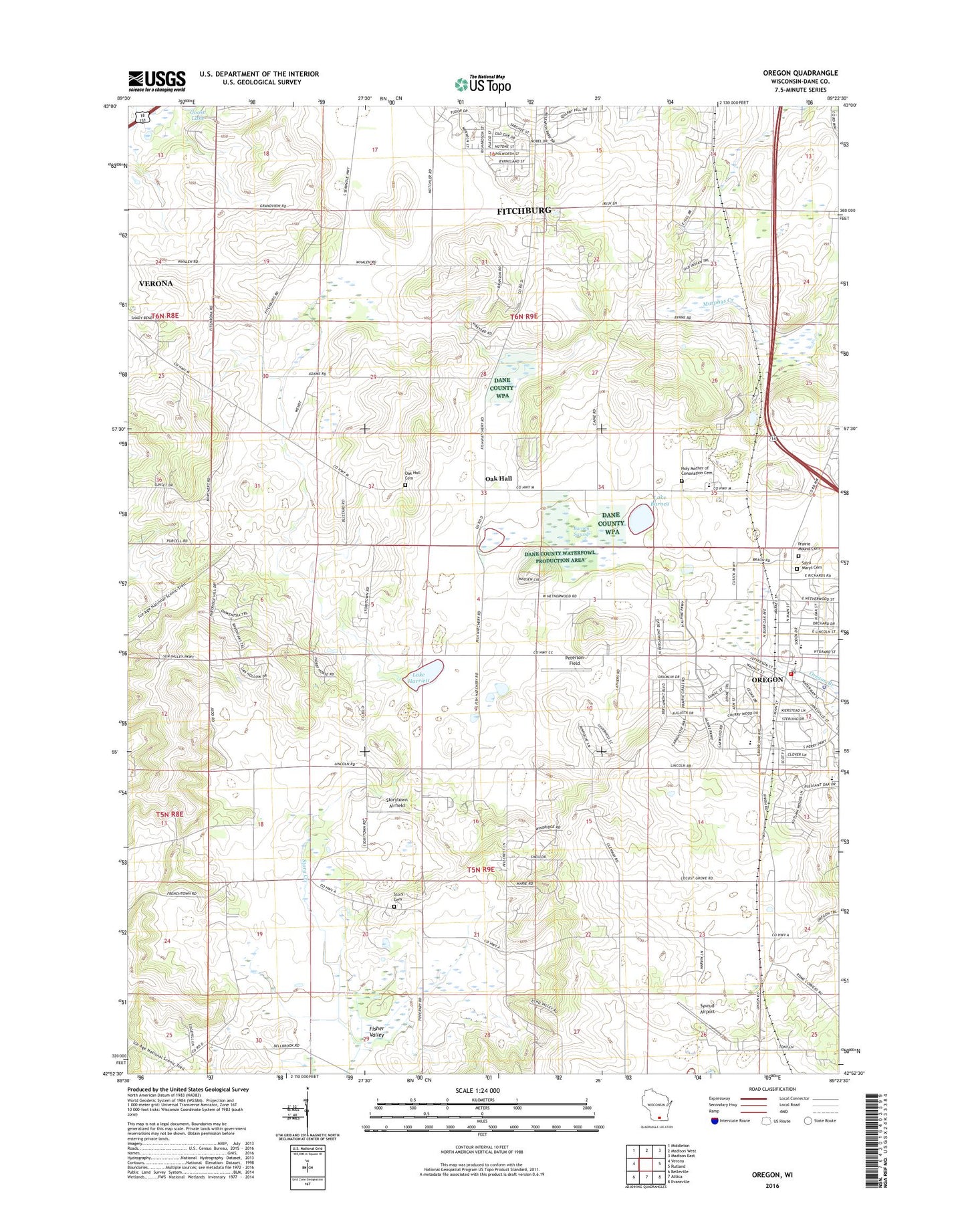
Oregon Wisconsin US Topo Map
Couldn't load pickup availability
2022 topographic map quadrangle Oregon in the state of Wisconsin. Scale: 1:24000. Based on the newly updated USGS 7.5' US Topo map series, this map is in the following counties: Dane. The map contains contour data, water features, and other items you are used to seeing on USGS maps, but also has updated roads and other features. This is the next generation of topographic maps. Printed on high-quality waterproof paper with UV fade-resistant inks.
Quads adjacent to this one:
West: Verona
Northwest: Middleton
North: Madison West
Northeast: Madison East
East: Rutland
Southeast: Evansville
South: Attica
Southwest: Belleville
This map covers the same area as the classic USGS quad with code o42089h4.
Contains the following named places: Barney Swamp, Carandale Farm, City of Fitchburg, Eplegaarden, Faith Evangelical Lutheran Church, First United Presbyterian Church, Fisher Valley, Fitchburg, Fitchburg Center School, Hann's Christmas Farm, Holy Mother of Consolation Catholic Church, Lake Barney, Lake Harriet Cemetery, Lake Harriett, Maher Pond, Maples Corners School, Netherwood Knoll Elementary School, Oak Hall, Oak Hall Cemetery, Oakhill Correctional Institution, Oakhill Correctional Institution School, Oregon, Oregon Area Fire and Emergency Medical Services District, Oregon Middle School, Oregon Police Department, Oregon Post Office, Oregon Public Library, Oregon State Camp and Farm, Oregon Village Hall, Oregon Water Tower, Outhouse Farm, Peoples United Methodist Church, Peterson Field, Prairie Mound Cemetery, Prairie View Elementary School, Rome Corners Intermediate School, Saint Mary's Catholic Cemetery, Saint Mary's Cemetery, Stoner School, Stony Hill Farm, Story, Storytown Airfield, Storytown Cemetery, Syvrud Airport, Town of Oregon, Village of Oregon, WIBA-AM (Madison), Winterland Nursery, WMGN-FM (Madison), Wolf Mink Ranch, ZIP Code: 53575