MyTopo
Oshkosh NW Wisconsin US Topo Map
Couldn't load pickup availability
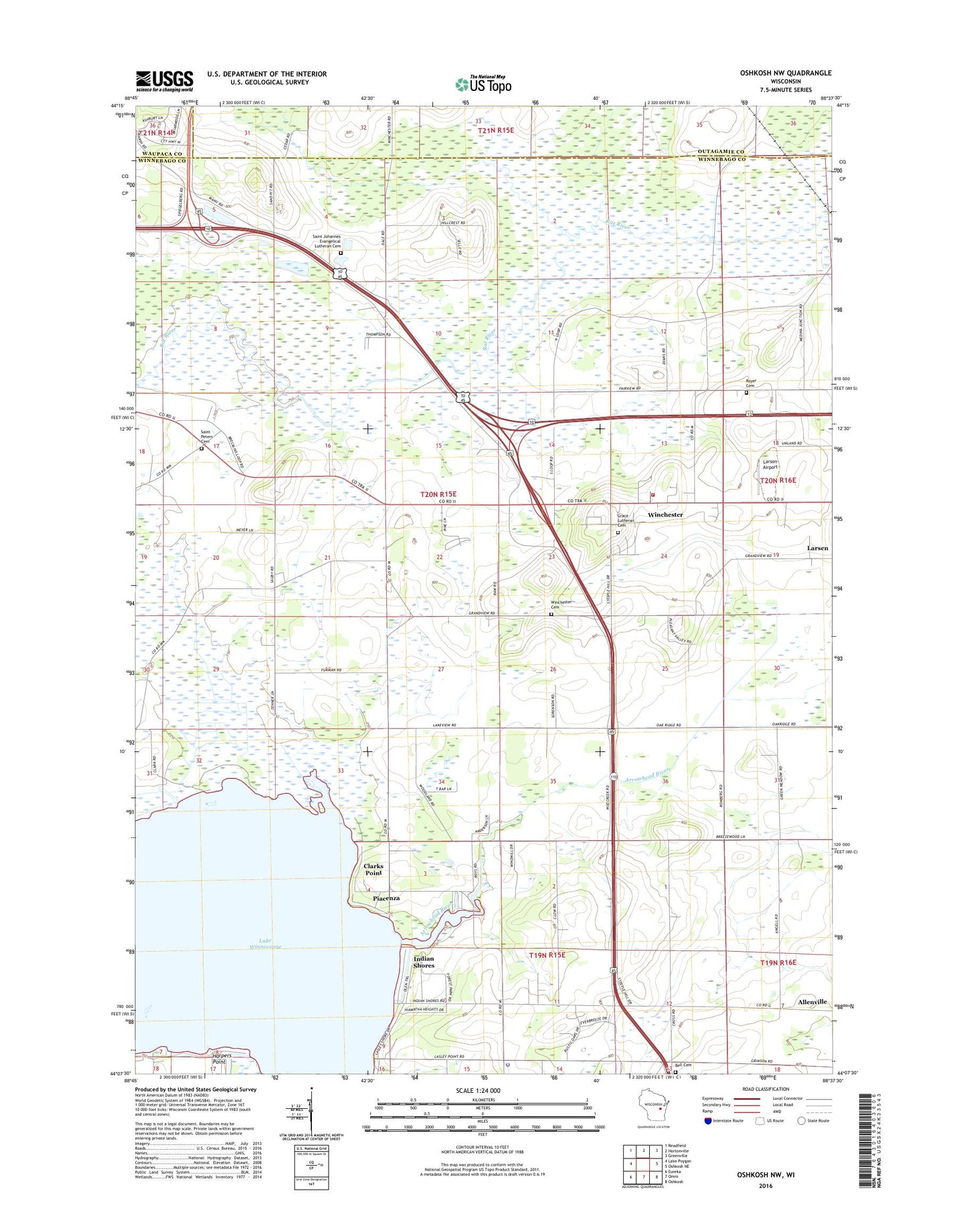
2018 topographic map quadrangle Oshkosh NW in the state of Wisconsin. Scale: 1:24000. Based on the newly updated USGS 7.5' US Topo map series, this map is in the following counties: Winnebago, Outagamie, Waupaca. The map contains contour data, water features, and other items you are used to seeing on USGS maps, but also has updated roads and other features. This is the next generation of topographic maps. Printed on high-quality waterproof paper with UV fade-resistant inks.
Quads adjacent to this one:
West: Lake Poygan
Northwest: Readfield
North: Hortonville
Northeast: Greenville
East: Oshkosh NE
Southeast: Oshkosh
South: Omro
Southwest: Eureka
Contains the following named places: Arrowhead River, Bell Cemetery, Breezehill Farm, Clarks Point, Clayton - Winchester Fire Department Station 44, Cross Farm, Eckstein Farm, Grace Lutheran Cemetery, Grace Lutheran Church, Harpers Point, Indian Shores, Kunde Farm, Lake Winneconne, Larsen Farm, Larson Airport, Lasleys Point, Ledgerock Dairy, Mathison School, Medina Station, Olson Farms, Paradise Farm, Peterson Farms, Piacenza, Royer Cemetery, Saint Johannes Cemetery, Saint Peters Cemetery, Town of Winchester, Winchester, Winchester Cemetery, Winchester Census Designated Place, Winchester Elementary School, Winneconne Town Police Department, Woodland Farm, ZIP Code: 54947