MyTopo
Greenville Wisconsin US Topo Map
Couldn't load pickup availability
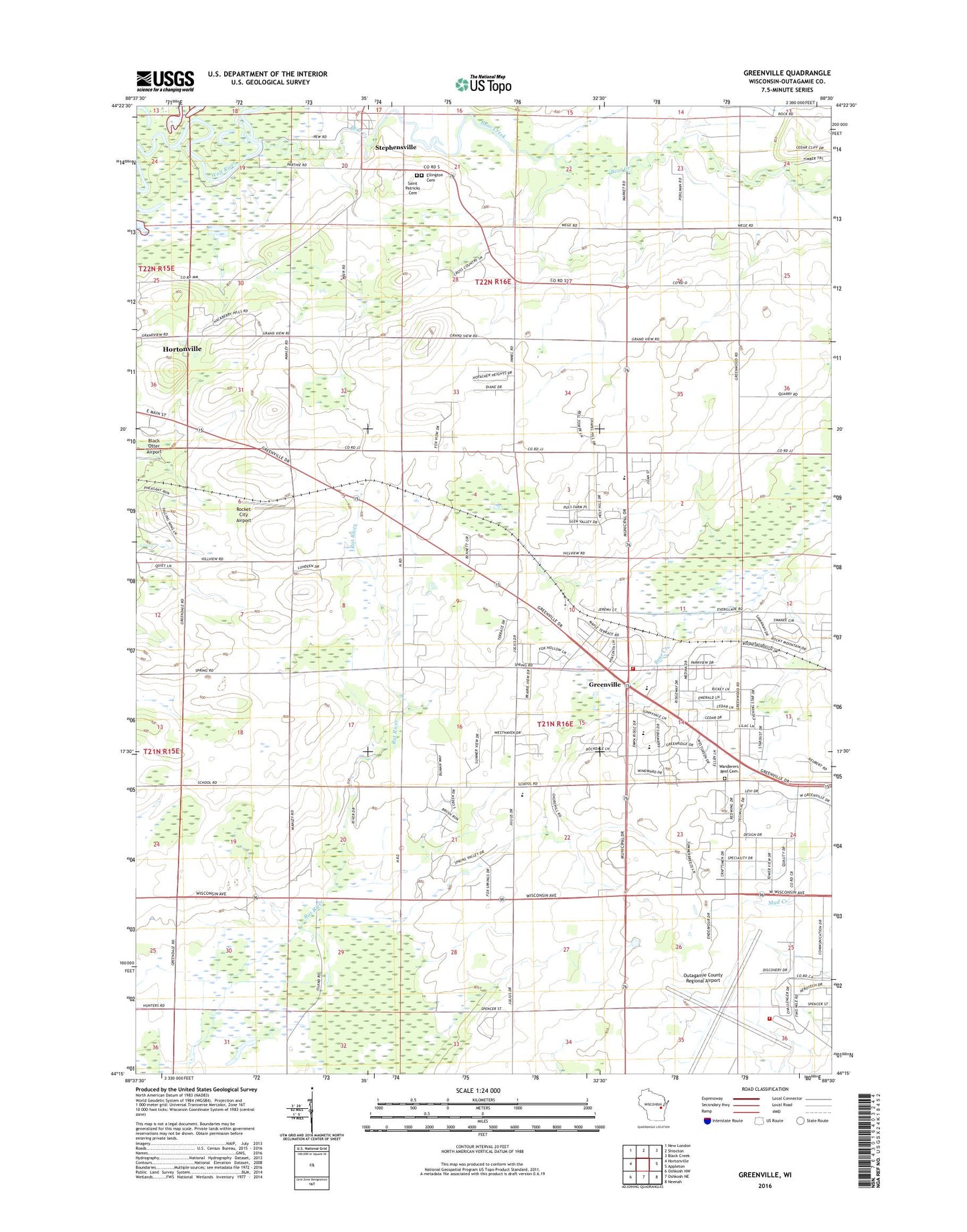
2022 topographic map quadrangle Greenville in the state of Wisconsin. Scale: 1:24000. Based on the newly updated USGS 7.5' US Topo map series, this map is in the following counties: Outagamie. The map contains contour data, water features, and other items you are used to seeing on USGS maps, but also has updated roads and other features. This is the next generation of topographic maps. Printed on high-quality waterproof paper with UV fade-resistant inks.
Quads adjacent to this one:
West: Hortonville
Northwest: New London
North: Shiocton
Northeast: Black Creek
East: Appleton
Southeast: Neenah
South: Oshkosh NE
Southwest: Oshkosh NW
This map covers the same area as the classic USGS quad with code o44088c5.
Contains the following named places: Appleton International Airport, Bear Creek, Cedar Grove School, Ellington Union Cemetery, Elm Grove Center School, Elm Tree School, Grandview School, Greenville, Greenville Elementary School, Greenville Middle School, Greenville Post Office, Greenville Volunteer Fire Department, Happy Valley School, Hillside Cooperative Preschool, Immanuel Church, Immanuel Evangelical Lutheran School, Immanuel School, Lutheran School, Medina Pit, Outagamie County Regional Airport Fire Department, Pleasant Corners School, Pleasant Vale School, Rocket City Airport, Saint Mary Convent, Saint Mary of the Immaculate Conception School, Saint Patricks Cemetery, Stephensville, Sunny Slope School, Sunny View School, Town of Ellington, Township of Greenville, Trinity Evangelical Church, United Church, Village of Greenville, Wanderers Rest Cemetery, Wide Awake School, ZIP Code: 54942