MyTopo
Parkland Wisconsin US Topo Map
Couldn't load pickup availability
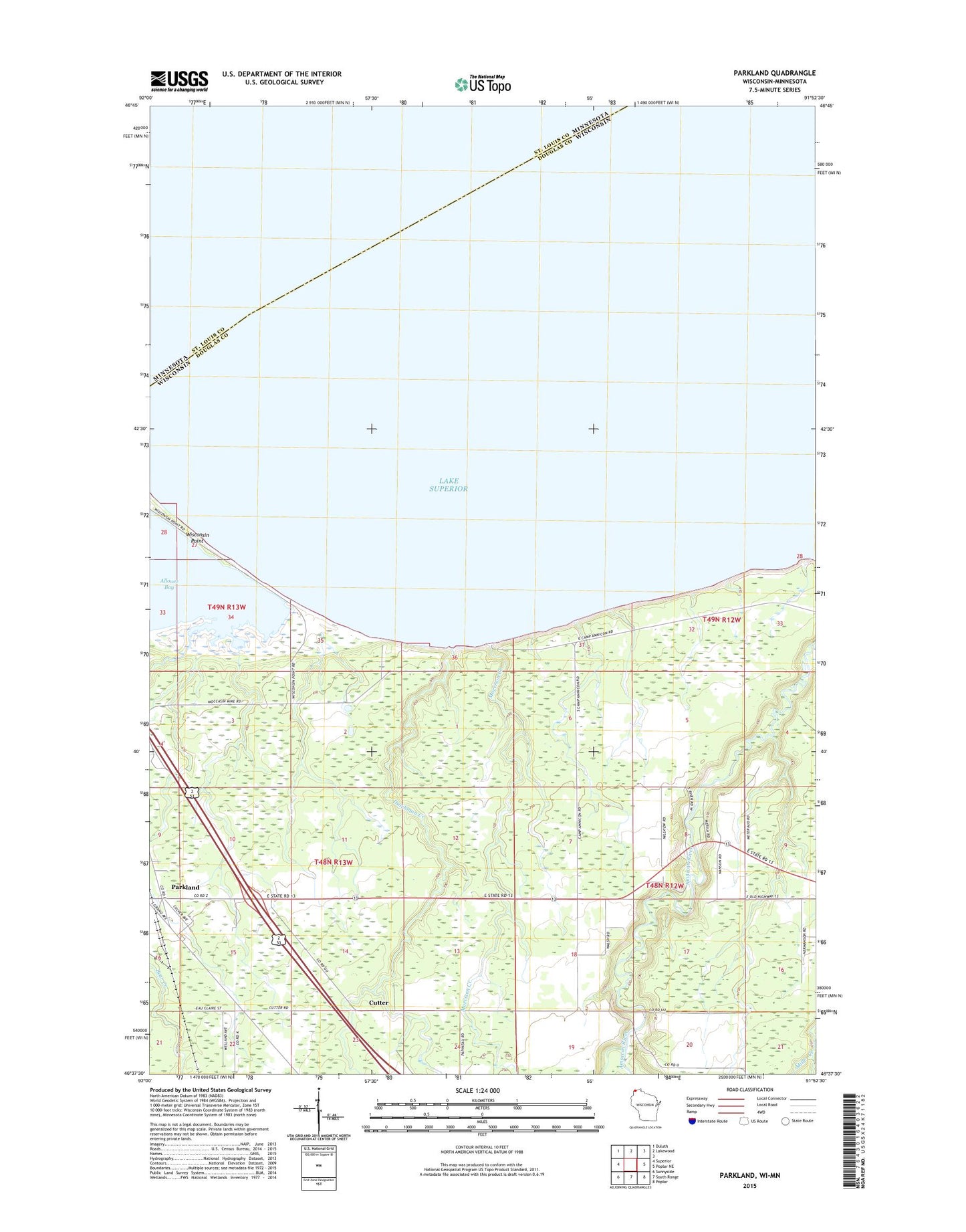
2022 topographic map quadrangle Parkland in the state of Wisconsin. Scale: 1:24000. Based on the newly updated USGS 7.5' US Topo map series, this map is in the following counties: Douglas, St. Louis. The map contains contour data, water features, and other items you are used to seeing on USGS maps, but also has updated roads and other features. This is the next generation of topographic maps. Printed on high-quality waterproof paper with UV fade-resistant inks.
Quads adjacent to this one:
West: Superior
Northwest: Duluth
North: Lakewood
East: Poplar NE
Southeast: Poplar
South: South Range
Southwest: Sunnyside
This map covers the same area as the classic USGS quad with code o46091f8.
Contains the following named places: Bear Creek, Cutter, Dutchman Creek, Millview Community Club, Morrison Creek, Parkland, Superior Landfill, WEBC Radio Tower (Seattle)