MyTopo
Sunnyside Wisconsin US Topo Map
Couldn't load pickup availability
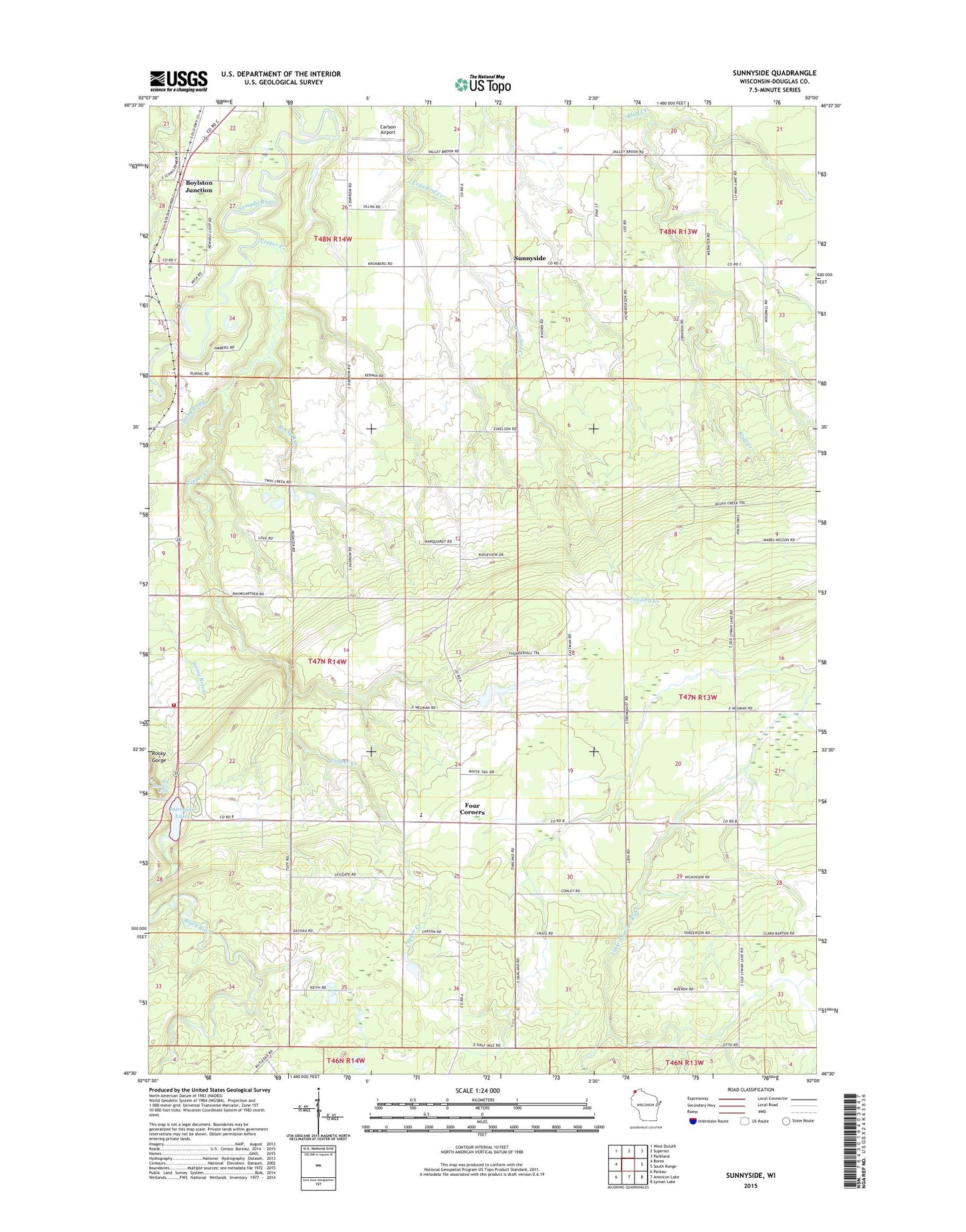
2022 topographic map quadrangle Sunnyside in the state of Wisconsin. Scale: 1:24000. Based on the newly updated USGS 7.5' US Topo map series, this map is in the following counties: Douglas. The map contains contour data, water features, and other items you are used to seeing on USGS maps, but also has updated roads and other features. This is the next generation of topographic maps. Printed on high-quality waterproof paper with UV fade-resistant inks.
Quads adjacent to this one:
West: Borea
Northwest: West Duluth
North: Superior
Northeast: Parkland
East: South Range
Southeast: Lyman Lake
South: Amnicon Lake
Southwest: Patzau
This map covers the same area as the classic USGS quad with code o46092e1.
Contains the following named places: Big Manitou Falls, Birch Creek, Boylston Junction, Carlson Airport, Concrete School, Copper Creek, Four Corners, Four Corners Elementary School, Interfalls Lake, Manitou Falls Church, Maranatha Academy, Oakland School, Pattison State Park, Pattison State Park WP433 Dam, Rocky Gorge, Rocky Run, Stony Brook, Sunnyside, Superior Township Volunteer Fire Department, Wesleyan Church