MyTopo
Princeton East Wisconsin US Topo Map
Couldn't load pickup availability
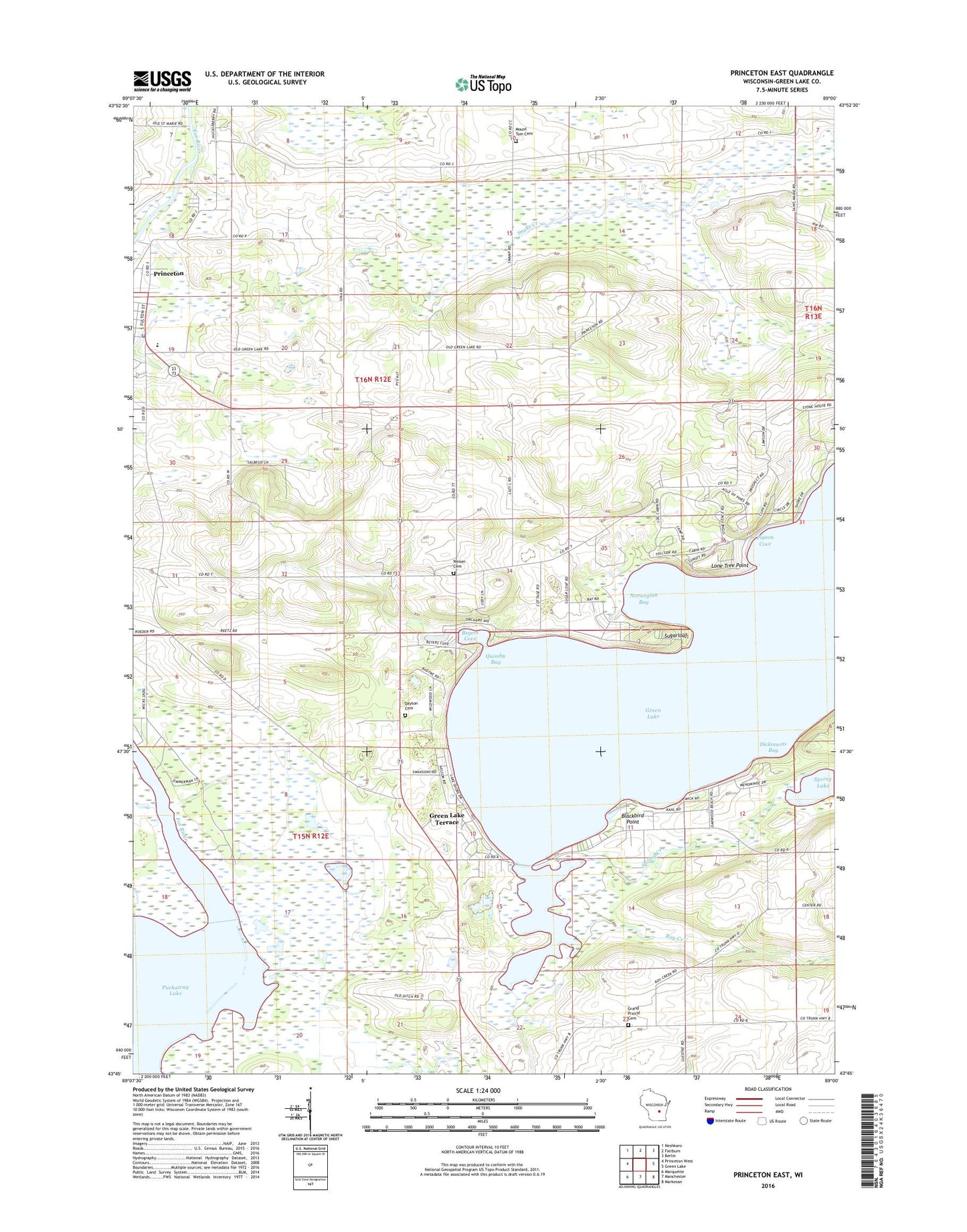
2018 topographic map quadrangle Princeton East in the state of Wisconsin. Scale: 1:24000. Based on the newly updated USGS 7.5' US Topo map series, this map is in the following counties: Green Lake. The map contains contour data, water features, and other items you are used to seeing on USGS maps, but also has updated roads and other features. This is the next generation of topographic maps. Printed on high-quality waterproof paper with UV fade-resistant inks.
Quads adjacent to this one:
West: Princeton West
Northwest: Neshkoro
North: Fairburn
Northeast: Berlin
East: Green Lake
Southeast: Markesan
South: Manchester
Southwest: Marquette
Contains the following named places: Bed-Ah-Wick Field, Beyers Cove, Blackbird Point, Dayton Cemetery, Dickinsons Bay, Emmanuel United Methodist Church, Golf Courses of Lawsonia, Grand Prairie Cemetery, Green Lake, Green Lake Conference Center, Green Lake County, Green Lake Terrace, Greenwyck, Lakewood Estates, Lone Tree Point, Mount Tom Cemetery, Norwegian Bay, Pigeon Cove, Pleasant Valley Church, Princeton, Princeton Police Department, Princeton School, Quimby Bay, Roy Creek, School Number 1, School Number 11, School Number 12, School Number 2, School Number 3, School Number 5, School Number 6, School Number 8, Snake Creek, Snake Creek Fen State Natural Area, Spring Creek, Spring Lake, Sugarloaf, Sylvan Shores, Terrace Shores Evangelical Free Church, Town of Princeton, Weiser Cemetery