MyTopo
Marquette Wisconsin US Topo Map
Couldn't load pickup availability
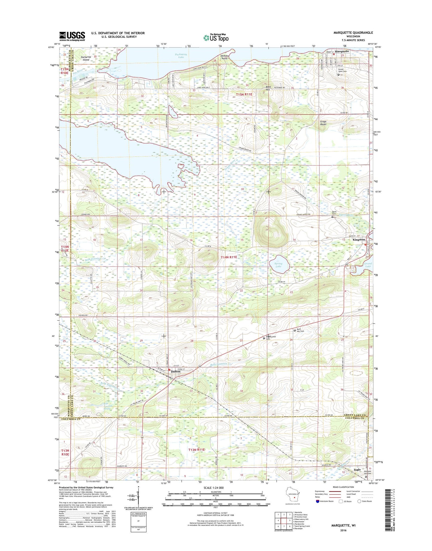
2022 topographic map quadrangle Marquette in the state of Wisconsin. Scale: 1:24000. Based on the newly updated USGS 7.5' US Topo map series, this map is in the following counties: Green Lake, Columbia, Marquette. The map contains contour data, water features, and other items you are used to seeing on USGS maps, but also has updated roads and other features. This is the next generation of topographic maps. Printed on high-quality waterproof paper with UV fade-resistant inks.
Quads adjacent to this one:
West: Observatory Hill
Northwest: Montello
North: Princeton West
Northeast: Princeton East
East: Manchester
Southeast: Randolph
South: Sand Spring Creek
Southwest: Pardeeville
This map covers the same area as the classic USGS quad with code o43089f2.
Contains the following named places: Belle Fountain School, Belle Fountain Spring, Dalton, Dalton Census Designated Place, Dalton Volunteer Fire Department, Dartt Cemetery, Engle School, Fountain Creek Wet Prairie State Natural Area, Grand Lake 102, Grand River Marsh State Public Hunting Grounds, Grand View Cemetery, Grays Rocks, Greenwood Cemetery, Hickory Point, Kingston, Kingston 1850c189 Dam, Kingston Post Office, Kingston Volunteer Fire Department, Marquette, Marquette Volunteer Fire Department, Pleasant Hill Cemetery, Rock Hill, Rock Hill Cemetery, Rock Hill School, Rocky Ridge School, Salem Church, Spring Lake, Spring Lake County Park, Town of Kingston, Village of Kingston, Village of Marquette, Zacharias Island, ZIP Codes: 53926, 53939, 53947