MyTopo
Random Lake Wisconsin US Topo Map
Couldn't load pickup availability
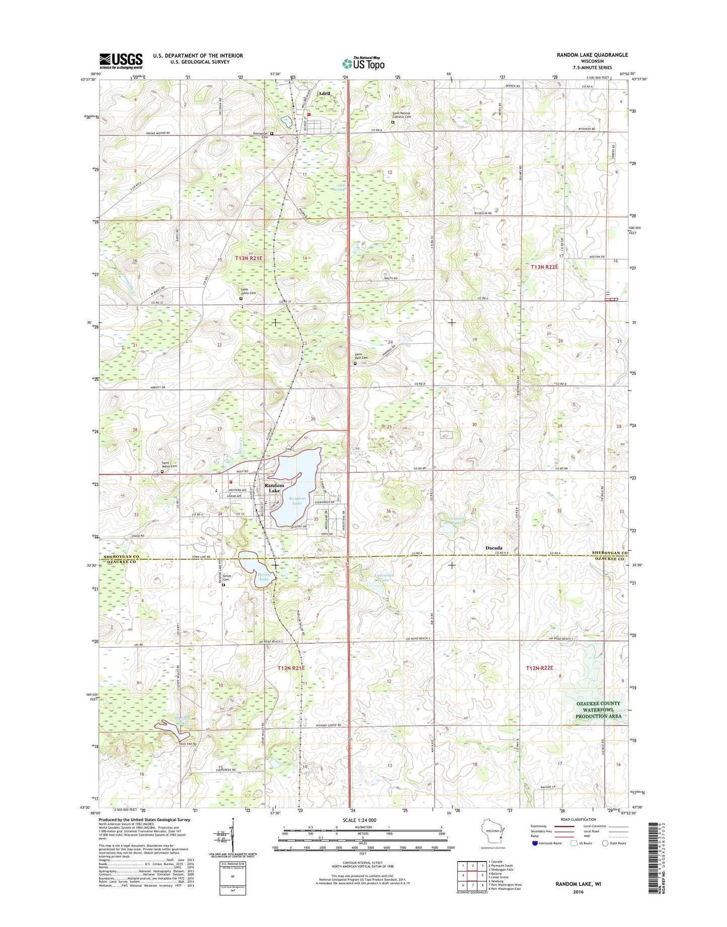
2022 topographic map quadrangle Random Lake in the state of Wisconsin. Scale: 1:24000. Based on the newly updated USGS 7.5' US Topo map series, this map is in the following counties: Sheboygan, Ozaukee. The map contains contour data, water features, and other items you are used to seeing on USGS maps, but also has updated roads and other features. This is the next generation of topographic maps. Printed on high-quality waterproof paper with UV fade-resistant inks.
Quads adjacent to this one:
West: Batavia
Northwest: Cascade
North: Plymouth South
Northeast: Sheboygan Falls
East: Cedar Grove
Southeast: Port Washington East
South: Port Washington West
Southwest: Newburg
This map covers the same area as the classic USGS quad with code o43087e8.
Contains the following named places: Adell, Adell Fire Department, Adell Post Office, Adell Swamp, Camp J C C, Dacada, Emmanuel Cemetery, Grasser Lake, Greene School, Hoard School, Huiras Lake, Huiras Lake State Natural Area, Lake View Park, Liberty School, Ludowissi Lake, Our Lady of the Lakes School, Ozaukee County Waterfowl Production Area, Random Lake, Random Lake Elementary School, Random Lake Fire Department, Random Lake High School, Random Lake Middle School, Random Lake Post Office, Saint John Lutheran School, Saint Johns Cemetery, Saint Marys Cemetery, Saint Patrick Catholic Cemetery, Saint Patrick Church, Saint Paul Church, Saint Pauls Lutheran Cemetery, Sherman Center, Spring Lake, Spring Lake Pit, Still Point Zen Center, Town of Fredonia, Town of Sherman, Union Cemetery, Village of Adell, Village of Random Lake, ZIP Code: 53075