MyTopo
Batavia Wisconsin US Topo Map
Couldn't load pickup availability
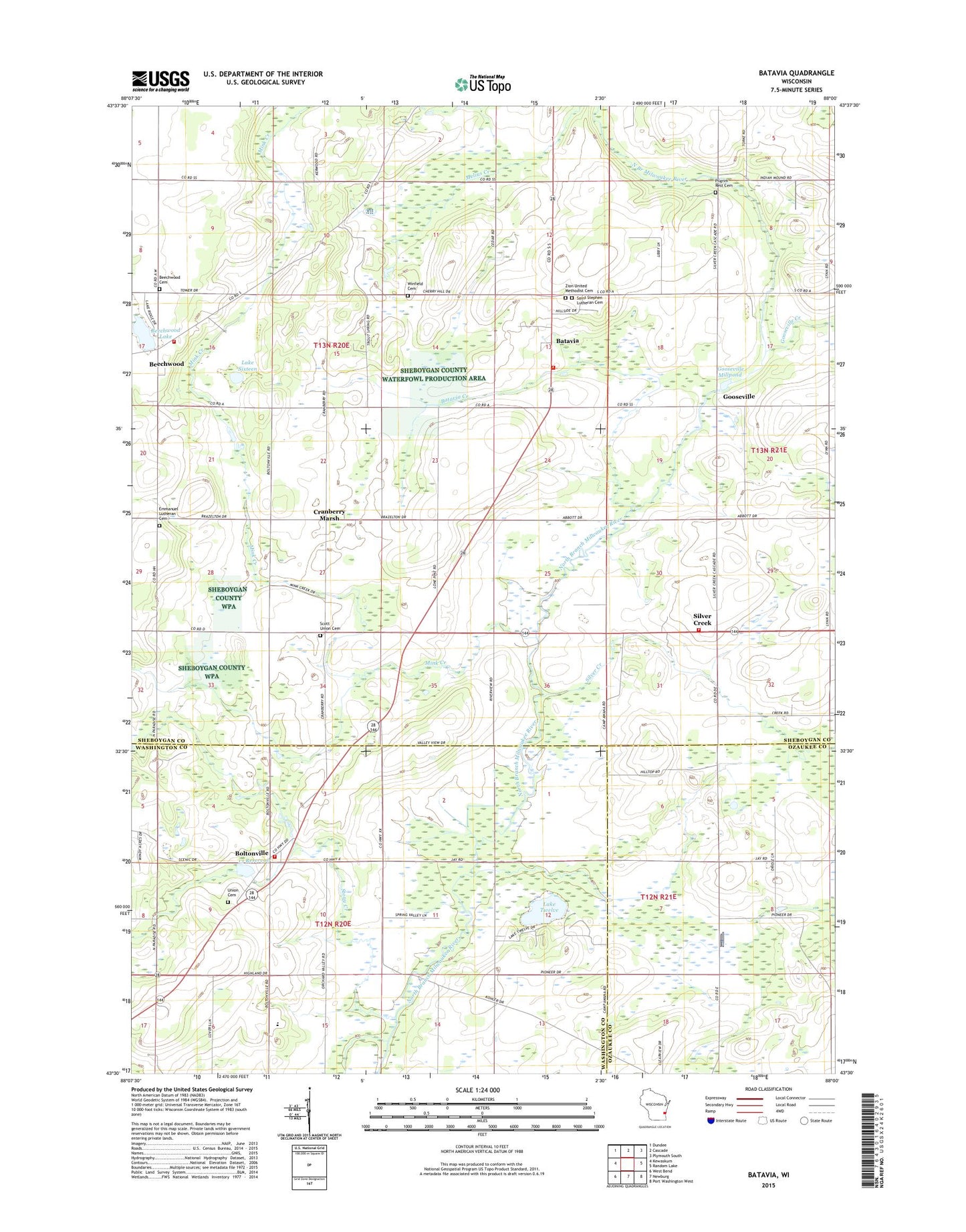
2022 topographic map quadrangle Batavia in the state of Wisconsin. Scale: 1:24000. Based on the newly updated USGS 7.5' US Topo map series, this map is in the following counties: Sheboygan, Washington, Ozaukee. The map contains contour data, water features, and other items you are used to seeing on USGS maps, but also has updated roads and other features. This is the next generation of topographic maps. Printed on high-quality waterproof paper with UV fade-resistant inks.
Quads adjacent to this one:
West: Kewaskum
Northwest: Dundee
North: Cascade
Northeast: Plymouth South
East: Random Lake
Southeast: Port Washington West
South: Newburg
Southwest: West Bend
This map covers the same area as the classic USGS quad with code o43088e1.
Contains the following named places: 13 Reservoir, 53001, Batavia, Batavia Census Designated Place, Batavia Creek, Batavia Elementary School, Batavia Volunteer Fire Department, Batavis Pond, Beechwood, Beechwood Cemetery, Beechwood Lake, Beechwood Volunteer Fire Department, Boltonville, Boltonville 2WP1738 Dam, Boltonville Union Cemetery, Boltonville Volunteer Fire Department, Camp Awana, Cranberry Marsh, Farmington Elementary School, Firemans Park, Gooseville, Gooseville 3WR 1559 Dam, Gooseville Creek, Gooseville Millpond 40, Hartmann Pit, Hillside School, Immanuel Church, Immanuel Lutheran Cemetery, Lafollette School, Lake Sixteen, Lake Twelve, Longfellow School, Mink Creek, Pilgrims Rest Cemetery, Riverside Strip, Saint John of God Roman Catholic Church, Saint Stephens Lutheran Cemetery, Scott Center School, Scott Union Cemetery, Silver Creek, Silver Creek Volunteer Fire Department, Stony Creek, Town of Scott, Winfield Cemetery, Zion United Methodist Cemetery