MyTopo
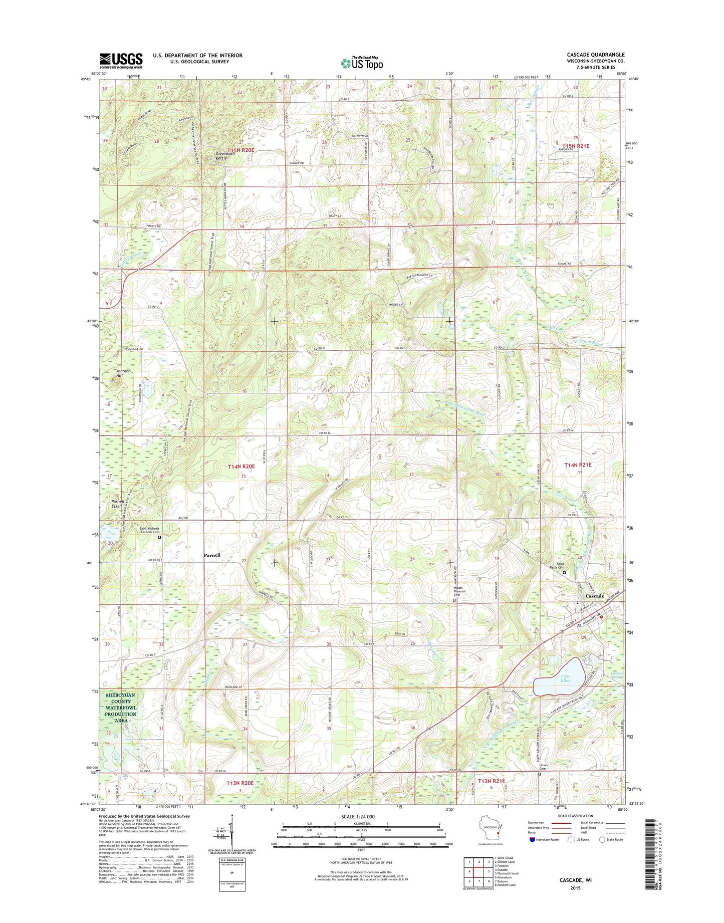
Cascade Wisconsin US Topo Map
Couldn't load pickup availability
2022 topographic map quadrangle Cascade in the state of Wisconsin. Scale: 1:24000. Based on the newly updated USGS 7.5' US Topo map series, this map is in the following counties: Sheboygan. The map contains contour data, water features, and other items you are used to seeing on USGS maps, but also has updated roads and other features. This is the next generation of topographic maps. Printed on high-quality waterproof paper with UV fade-resistant inks.
Quads adjacent to this one:
West: Dundee
Northwest: Saint Cloud
North: Elkhart Lake
Northeast: Franklin
East: Plymouth South
Southeast: Random Lake
South: Batavia
Southwest: Kewaskum
This map covers the same area as the classic USGS quad with code o43088f1.
Contains the following named places: Ben Nutt Creek, Cascade, Cascade Elementary School, Cascade Fire Department, Cascade Police Department, Cascade Post Office, Chambers Creek, German Corners, Greenbush Campground, Greenbush Kettle, Johnson Hill, Johnson Hill Kame State Natural Area, Lake Ellen, Lyndon Mitchell School, Melius Creek, Mill Creek, Mount Pleasant Cemetery, Nichols Creek State Wildlife Area, Parnell, Parnell Elementary School, Parnell Observation Tower, Saint Michael Church, Saint Michael's Cemetery, Saint Paul's Cemetery, Sheboygan County Waterfowl Production Area, South Prairie School, Spring Farm School, Town of Mitchell, Union Cemetery, Victor School, Village of Cascade, ZIP Code: 53011