MyTopo
Reservoir Pond Wisconsin US Topo Map
Couldn't load pickup availability
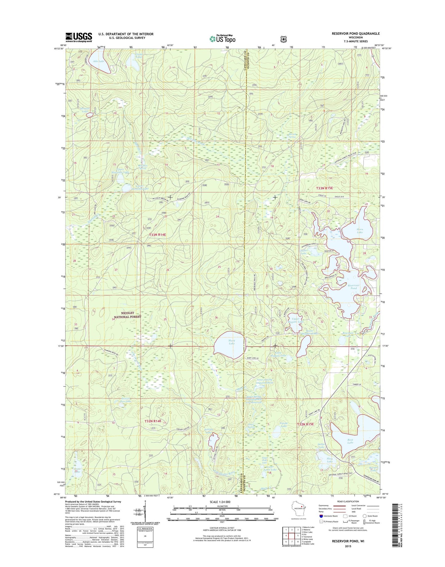
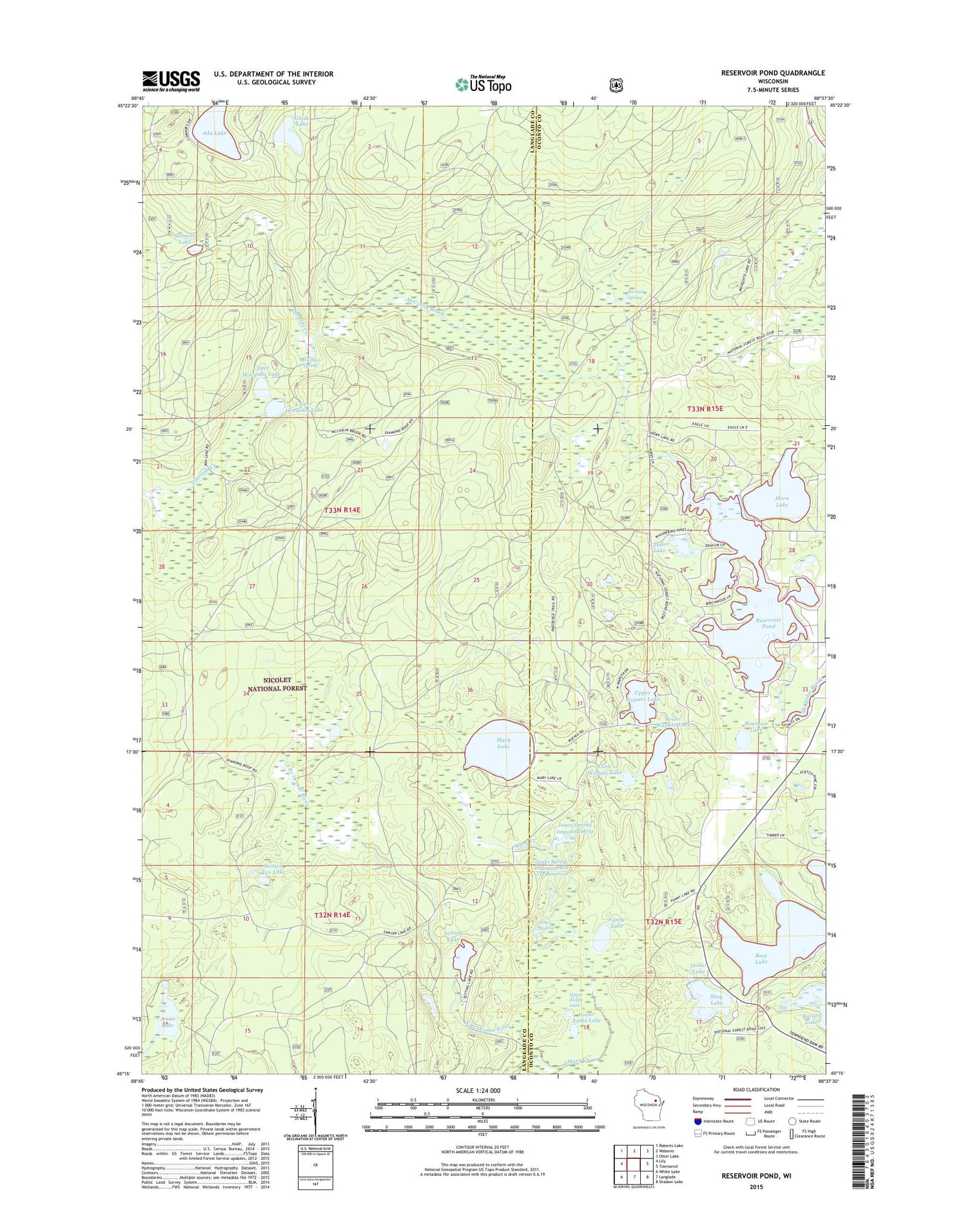
2018 topographic map quadrangle Reservoir Pond in the state of Wisconsin. Scale: 1:24000. Based on the newly updated USGS 7.5' US Topo map series, this map is in the following counties: Langlade, Oconto. The map contains contour data, water features, and other items you are used to seeing on USGS maps, but also has updated roads and other features. This is the next generation of topographic maps. Printed on high-quality waterproof paper with UV fade-resistant inks.
Quads adjacent to this one:
West: Lily
Northwest: Roberts Lake
North: Wabeno
Northeast: Otter Lake
East: Townsend
Southeast: Shadow Lake
South: Langlade
Southwest: White Lake
Contains the following named places: Ada Lake, Ada Lake Campground, Ada Lake Lookout Tower, Adirondack Shelter, Barney Creek State Natural Area, Barney Spring, Boot Lake, Boot Lake Campground, Bowman Lake, Dollar Lake, Explosion Lake, Fanny Lake, Fanny Lake Walk-in Campground, Glade Lake, Horn Lake, Horn Shaped Lake, Jessie Lake, Jones Spring, Jones Spring E31.25 Dam, Jones Spring Impoundment, Jones Springs Management Area, Lauder Lake, Little Horn Lake, Little Wapato Lake, Lower Hiwanka Lake, Lower Jones Lake, Lower Wapato Lake, Mary Creek, Mary Lake, McCaslin Spring, Popple Ridge Snowmobile Trail, Reservoir 2 WP 463 Dam, Reservoir Pond, Reservoir Pond 22.0, Sasacat Creek, Sasacat Lake, Section Ten Lake, Setting Lake, Shay Lake, Upper Hiwanka Lake, Upper Jones Lake, Upper Wapato Lake