MyTopo
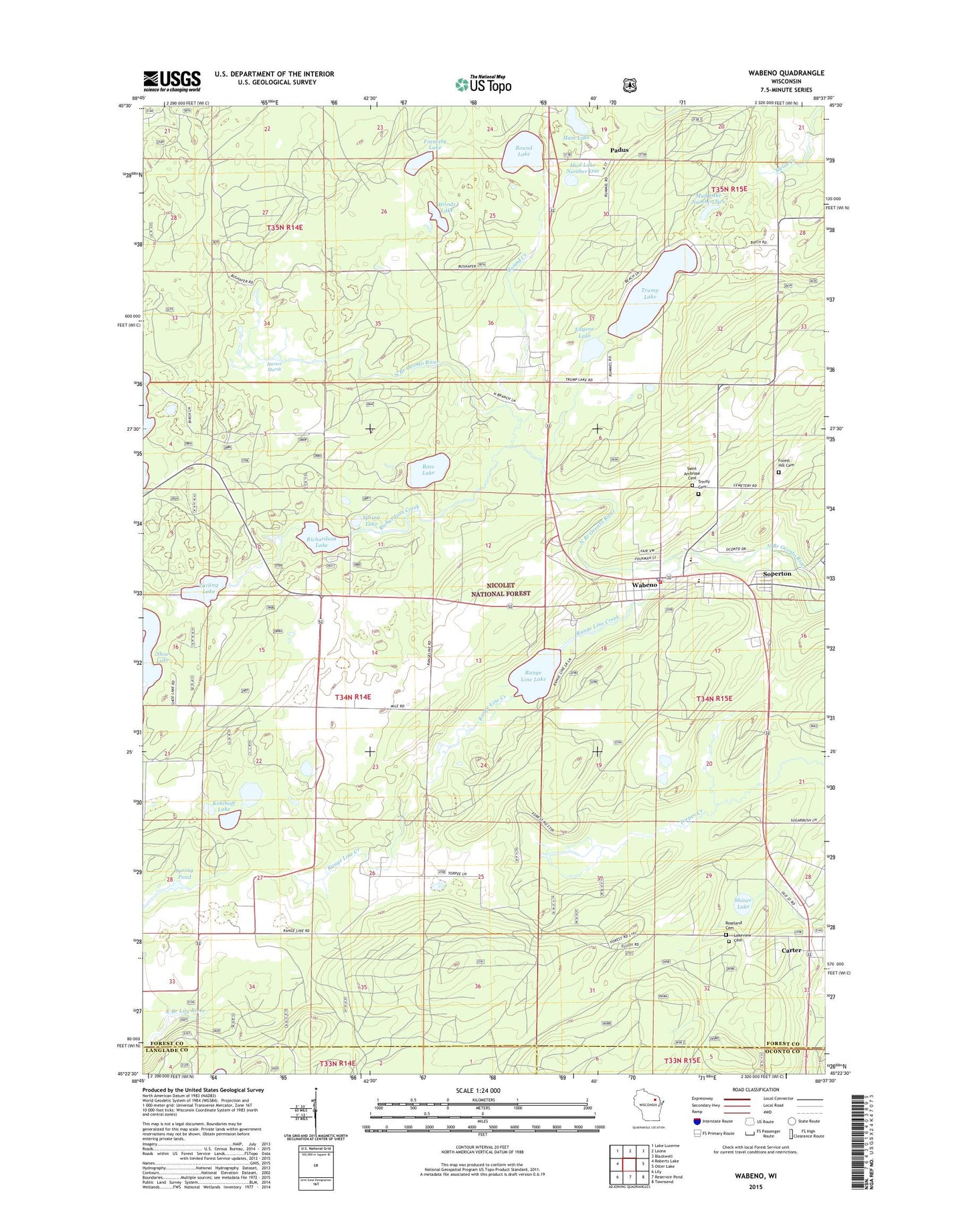
Wabeno Wisconsin US Topo Map
Couldn't load pickup availability
Also explore the Wabeno Forest Service Topo of this same quad for updated USFS data
2022 topographic map quadrangle Wabeno in the state of Wisconsin. Scale: 1:24000. Based on the newly updated USGS 7.5' US Topo map series, this map is in the following counties: Forest, Langlade, Oconto. The map contains contour data, water features, and other items you are used to seeing on USGS maps, but also has updated roads and other features. This is the next generation of topographic maps. Printed on high-quality waterproof paper with UV fade-resistant inks.
Quads adjacent to this one:
West: Roberts Lake
Northwest: Lake Lucerne
North: Laona
Northeast: Blackwell
East: Otter Lake
Southeast: Townsend
South: Reservoir Pond
Southwest: Lily
This map covers the same area as the classic USGS quad with code o45088d6.
Contains the following named places: Bass Lake, Carter, Carter Lookout Tower, Eugene Lake, Finnerty Lake, Forest Hill Cemetery, Freedom Corners, Freedom Townhall, Ham Lake, Harter Marsh, Indian Community Hall, Kohlhoff Lake, Lakeview Cemetery, Minertown, Mud Lake Number One, Mud Lake Number Two, Oneva, Padus, Padus Lookout Tower, Range Line Creek, Range Line Lake, Richardson Creek, Richardson Lake, Richardson Lake Campground, Roseland Cemetery, Round Creek, Round Lake, Rummel School, Saint Ambrose Cemetery, Shiner Lake, Soperton, Spring Lake, Spring Pond, Torpee Springs, Town of Freedom, Trinity Cemetery, Trump Lake, Wabeno, Wabeno Census Designated Place, Wabeno Elementary School, Wabeno High School, Wabeno Police Department, Wabeno Post Office, Wabeno Volunteer Fire Department, Windfall School, Woods Lake, Zarling Lake