MyTopo
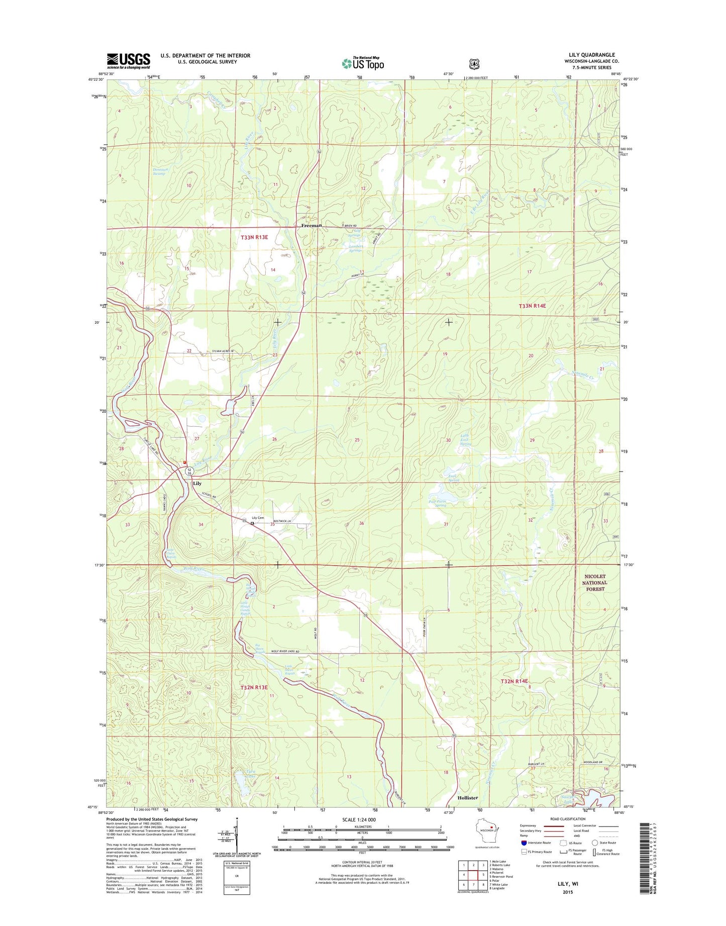
Lily Wisconsin US Topo Map
Couldn't load pickup availability
Also explore the Lily Forest Service Topo of this same quad for updated USFS data
2022 topographic map quadrangle Lily in the state of Wisconsin. Scale: 1:24000. Based on the newly updated USGS 7.5' US Topo map series, this map is in the following counties: Langlade. The map contains contour data, water features, and other items you are used to seeing on USGS maps, but also has updated roads and other features. This is the next generation of topographic maps. Printed on high-quality waterproof paper with UV fade-resistant inks.
Quads adjacent to this one:
West: Pickerel
Northwest: Mole Lake
North: Roberts Lake
Northeast: Wabeno
East: Reservoir Pond
Southeast: Langlade
South: White Lake
Southwest: Polar
This map covers the same area as the classic USGS quad with code o45088c7.
Contains the following named places: Adventist School, Big Sheen Rapids, Big Slough Gundy Rapids, Campbell Creek, Dennison Swamp, East Branch Lily River, Emil Spring, Freeman, Homestead Lake, Lambert Springs, Langlade Township Fire Department, Lily, Lily Cemetery, Lily River, Lily Springs, Lily Springs State Fishery Area, Little Emil Spring, Little Sheen Rapids, Little Slough Gundy Rapids, O'Brien Springs, Poor Farm Spring, Saint Claire Rapids, Town of Langlade, Tyra Lake, Upper Wolf River State Fishery Area