MyTopo
White Lake Wisconsin US Topo Map
Couldn't load pickup availability
Also explore the White Lake Forest Service Topo of this same quad for updated USFS data
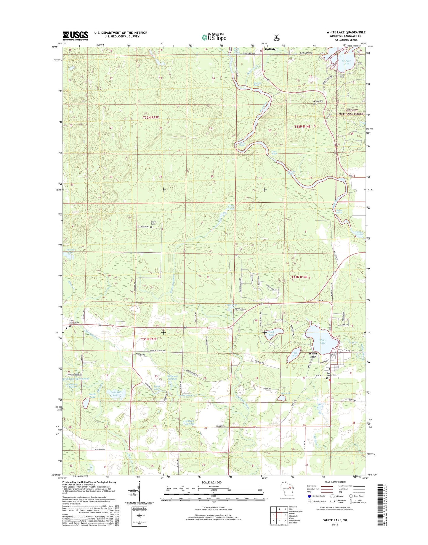
2022 topographic map quadrangle White Lake in the state of Wisconsin. Scale: 1:24000. Based on the newly updated USGS 7.5' US Topo map series, this map is in the following counties: Langlade. The map contains contour data, water features, and other items you are used to seeing on USGS maps, but also has updated roads and other features. This is the next generation of topographic maps. Printed on high-quality waterproof paper with UV fade-resistant inks.
Quads adjacent to this one:
West: Polar
Northwest: Pickerel
North: Lily
Northeast: Reservoir Pond
East: Langlade
Southeast: Markton
South: Perote Lake
Southwest: Zoar
This map covers the same area as the classic USGS quad with code o45088b7.
Contains the following named places: Bear Caves State Natural Area, Brown Cemetery, Burnt Point Rapids, Cedar Rapids, Cozy Corner School, Dark Lake, Evergreen Christian Academy, Evergreen Creek, Evergreen River State Fishery Area, Flora Lake, Flora Spring Pond State Natural Area, Four Corners, Galyan Springs, Hemlock Rapids, Hollister, Larzelere Rapids, Long Lake, Mable Lake, Ninemile Creek, Ninemile Hill, Ninemile Rapids, Our Lake, Oxbow Rapids, Oxbow Rapids Upper Wolf River State Natural Area, Porkey Lake, Saint James Cemetery, Sawyer Lake, Sherry Rapids, Stillhouse Springs, Sunshine Springs, Town Line Lake, Town of Evergreen, Troutland Rescue Squad, Twin Hill Lake, Village of White Lake, West Lake, White Lake, White Lake Elementary School, White Lake High School, White Lake Post Office, White Lake Volunteer Fire Department, Wilson School, ZIP Codes: 54430, 54491