MyTopo
Sauk Prairie Wisconsin US Topo Map
Couldn't load pickup availability
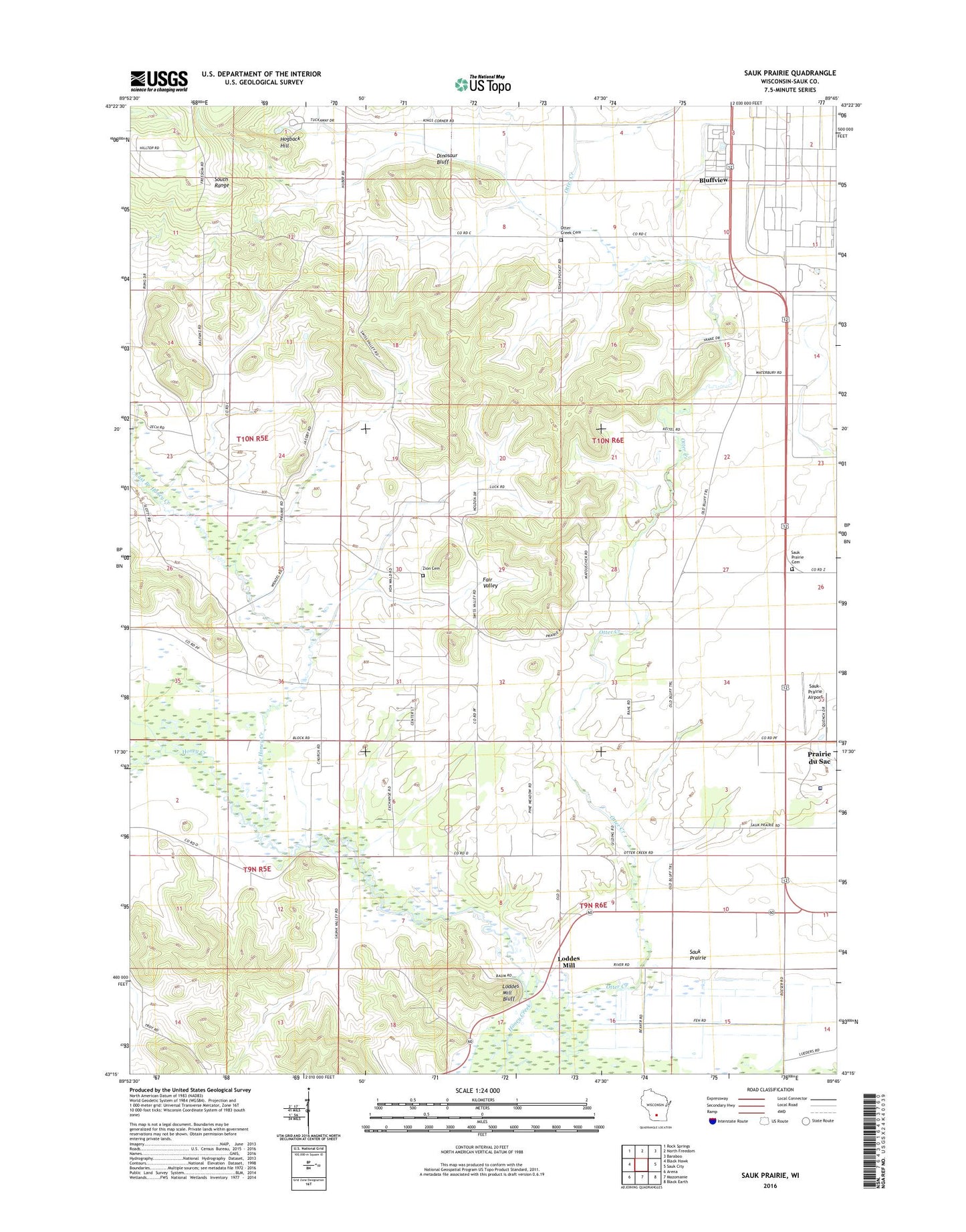
2022 topographic map quadrangle Sauk Prairie in the state of Wisconsin. Scale: 1:24000. Based on the newly updated USGS 7.5' US Topo map series, this map is in the following counties: Sauk. The map contains contour data, water features, and other items you are used to seeing on USGS maps, but also has updated roads and other features. This is the next generation of topographic maps. Printed on high-quality waterproof paper with UV fade-resistant inks.
Quads adjacent to this one:
West: Black Hawk
Northwest: Rock Springs
North: North Freedom
Northeast: Baraboo
East: Sauk City
Southeast: Black Earth
South: Mazomanie
Southwest: Arena
This map covers the same area as the classic USGS quad with code o43089c7.
Contains the following named places: Bluffview, Bluffview Census Designated Place, Dinosaur Bluff, East Branch Honey Creek, Hillside School, Ho-Chunk Nation Reservation, Hogback Hill, Loddes Mill, Loddes Mill Bluff, Lodde's Mill Bluff State Natural Area, Matousek Quarry, Otter Creek Cemetery, Saint Ida Convent, Salem Church, Sauk Prairie, Sauk Prairie Cemetery, Sauk Prairie Memorial Hospital, Sauk Prairie School, Sauk-Prairie Airport, Stones Pocket School, Town of Prairie du Sac, Town of Sumpter, Zion Cemetery, ZIP Codes: 53578, 53583