
MyTopo
Rusk Wisconsin US Topo Map
Couldn't load pickup availability
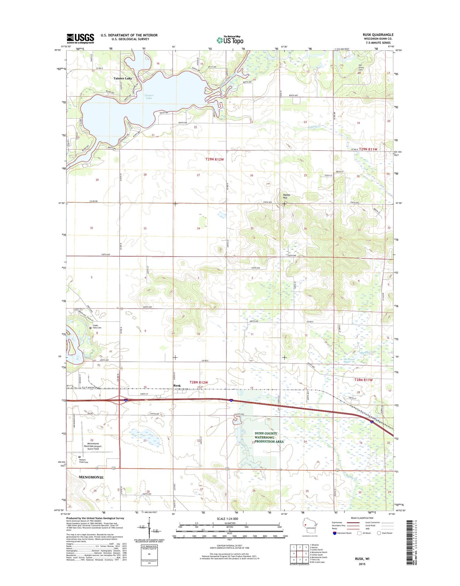
2018 topographic map quadrangle Rusk in the state of Wisconsin. Scale: 1:24000. Based on the newly updated USGS 7.5' US Topo map series, this map is in the following counties: Dunn. The map contains contour data, water features, and other items you are used to seeing on USGS maps, but also has updated roads and other features. This is the next generation of topographic maps. Printed on high-quality waterproof paper with UV fade-resistant inks.
Quads adjacent to this one:
West: Menomonie North
Northwest: Wheeler
North: Norton
Northeast: Colfax North
East: Colfax South
Southeast: Elk Creek Lake
South: Falls City
Southwest: Menomonie South
Contains the following named places: Beyer Settlement School, Cedar Falls Cemetery, Clearview School, Elk Mound Marsh, Hanke Hill, Hill Grove Cemetery, Knapp Settlement School, Lone Pine School, Lyndale School, Menomonie Municipal Airport-Score Field, Muddy Creek State Public Hunting Grounds, Ney School, Potters Field Cemetery, Prairie School, Rusk, Rusk Church, Rusk Post Office, Rusk School, Saint Katherine Church, Sherbourne Prairie, Sinking Creek, Tainter Church, Tainter Lake, Tainter Lake Census Designated Place, Town of Red Cedar, Town of Tainter


