MyTopo
Seymour Wisconsin US Topo Map
Couldn't load pickup availability
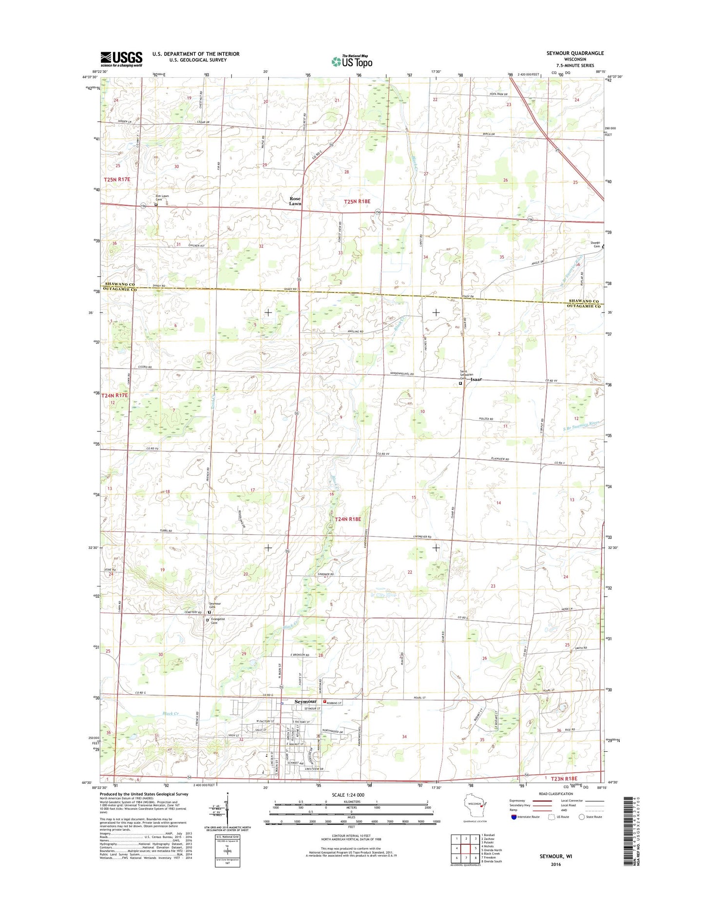
2018 topographic map quadrangle Seymour in the state of Wisconsin. Scale: 1:24000. Based on the newly updated USGS 7.5' US Topo map series, this map is in the following counties: Outagamie, Shawano. The map contains contour data, water features, and other items you are used to seeing on USGS maps, but also has updated roads and other features. This is the next generation of topographic maps. Printed on high-quality waterproof paper with UV fade-resistant inks.
Quads adjacent to this one:
West: Nichols
Northwest: Bonduel
North: Zachow
Northeast: Pulaski
East: Oneida North
Southeast: Oneida South
South: Freedom
Southwest: Black Creek
Contains the following named places: Assembly of God Church, Cherry Hill School, City of Seymour, Crystal Spring School, Elm Lawn Cemetery, Emmanuel Lutheran Cemetery, Idlewild School, Isaar, Nelson Quarry, North Seymour School, Oak Leaf School, Owego Cemetery, Pine Grove School, Plain View School, Rock Ledge Elementary School, Rock Ledge Park, Rose Lawn, Saint John the Baptist Catholic Church, Saint John the Baptist Grade School, Saint Sebastian Catholic Church, Saint Sebastian Cemetery, Seymour, Seymour Cemetery, Seymour Fire and Rescue Department, Seymour High School, Seymour Middle School, Seymour Police Department, Seymour Post Office, Seymour Township Volunteer Fire Department, Seymour Wastewater Treatment Plant, Town of Seymour, Woodlawn School, ZIP Code: 54165